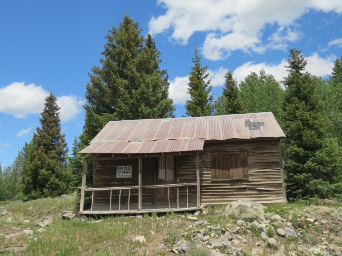
Boulder
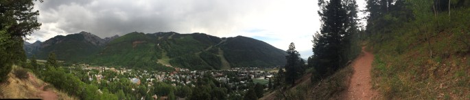
There aren’t many places I’ve visited where I’ve said, “I could live here!” Boulder is one. However, Boulder real estate is offered at California prices. Boulder was the perfect place to park and hang out with my niece, Theresa, from Florida.
I parked at the Elks Lodge in north Boulder (known as NoBo). It’s in a very nice neighborhood surrounded by open space and the Lodge had a pool!
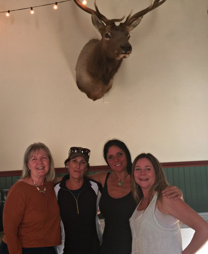
Boulder is a college town, so therefore it has all the wonderful things a college town has to offer…good entertainment, shops, museums, and great restaurants. I ended up staying in Boulder for five weeks, but during that time I flew to Florida to visit my family.
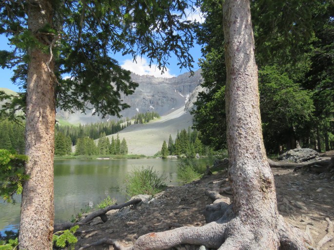
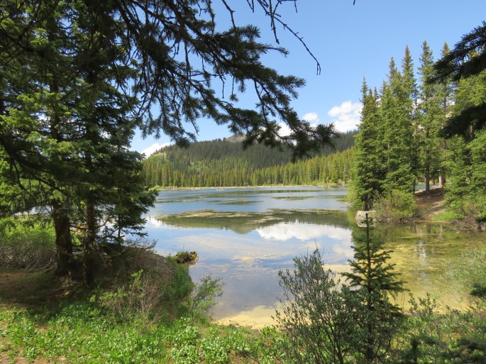
Theresa and I visited Rocky Mountain National Park, but it was a rainy and foggy day. I was so disappointed because that the only day Theresa had to visit the park. She never did get to use her new hiking boots. I did go back to visit the park after I returned from Florida and the weather was perfect.

Theresa is a huge Broncos fan and took a tour of the Stadium in Denver. We stopped by the LODO area downtown to have lunch and walk around.
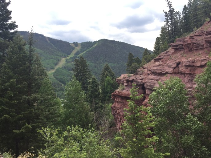
Theresa and I drove up to Boulder Falls and just a short walk took us to the base of the falls.
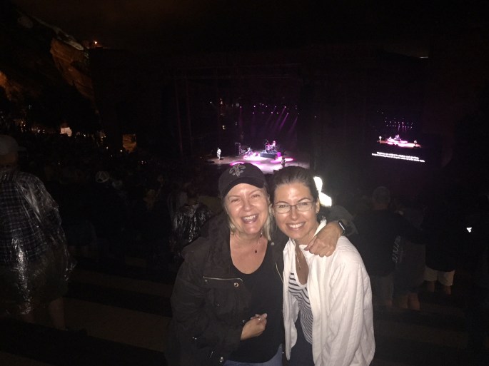
We also went to Red Rock Amphitheater to see Killer Queen. As you might think…they play Queen songs and the lead singer looked exactly like Freddy Mercury and they sounded great. Unfortunately, it rained throughout most of the concert. It was still a really good time. Red Rock Amphitheater was deemed the best music venue in the United States and it was really beautiful!
Theresa and I flew to Florida together and I visited family for a couple weeks. There are two new family members. Theresa is a grandmother! Her daughter, Arianna had a baby girl, Ashtyn, and my nephew Michael and his wife Lauren had a baby girl, Eloise. It was Eloise’s first birthday. It was a wonderful visit and I honestly had a hard time leaving.
After returning to Boulder, I had a few more things to check off my list before heading south.
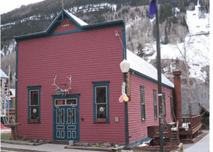
Of course, I had to visit the famous Pearl Street. It’s a very popular area for shops, galleries and great restaurants.
I spent a day in Denver to visit the Museum of Nature and Science. What a wonderful museum. The Dead Sea Scrolls were the visiting exhibit. In addition, the Imax theatre was showing a documentary on Bethlehem. I’ve always wanted to visit the Holy Land, not because I’m religious, but because of the amazing history of the region. I’d like to visit Egypt too. I wish I had done it years ago before the turmoil we have now. It was a wonderful and educational day. I ended the day with dinner at Fish and Beer in the artsy, fartsy section of Denver called RiNo (River North Art District). The food was delish!
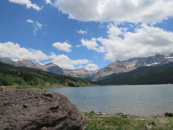
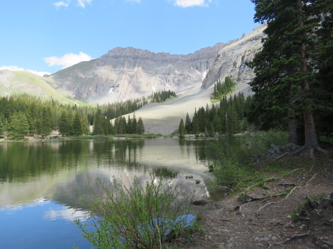
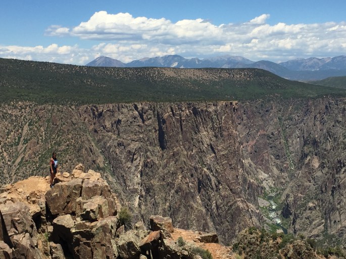
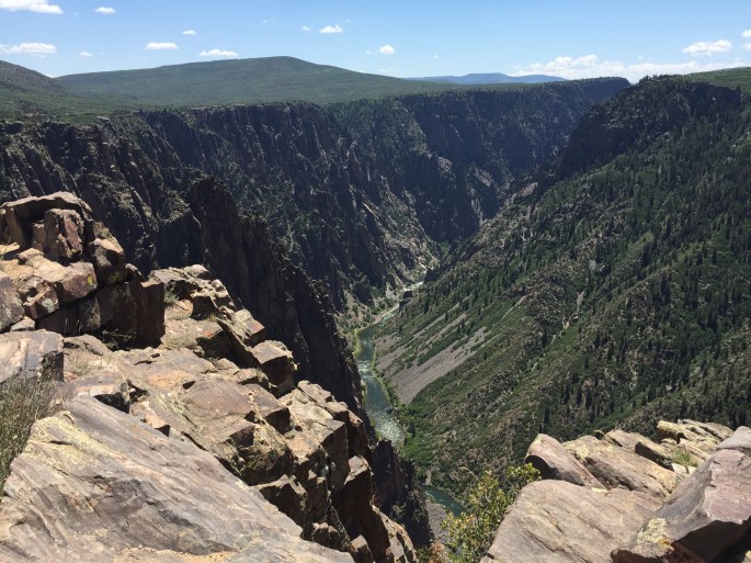
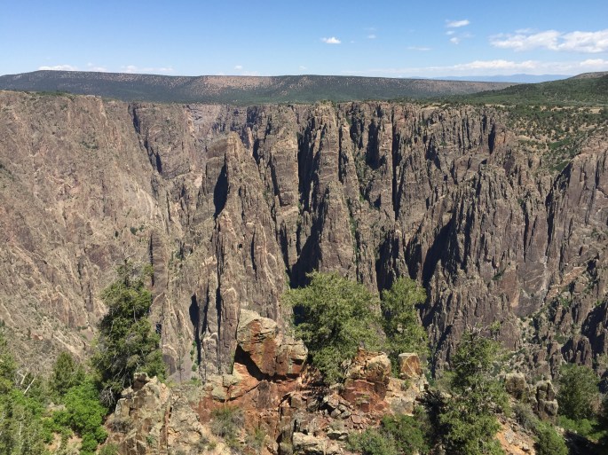
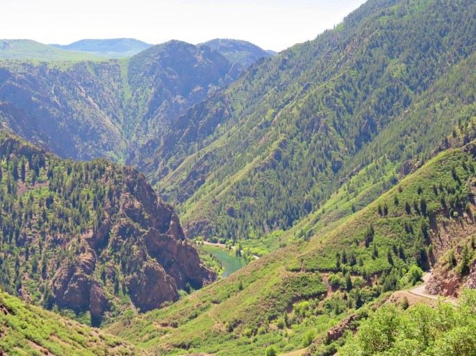
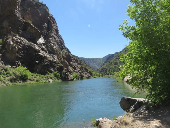
I did make another trip up to Rocky Mountain National Park (RMNP) and this time the weather cooperated. I had visited the park when I was 19 years old. I remember it being beautiful, but I hadn’t seen places like Yellowstone, Bryce, Zion, Grand Canyon, etc. In comparison, RMNP is not that spectacular, but beautiful nonetheless. The one thing that was unique was hiking on the tundra at over 11,400 feet. It was slow going, but I made it! The main road through the park is Trail Ridge Road and is the highest highway in the US.
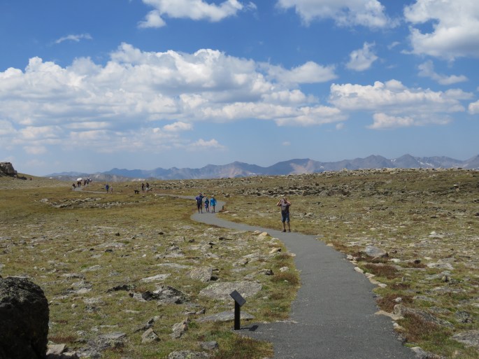
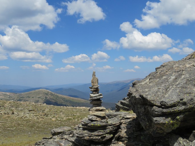
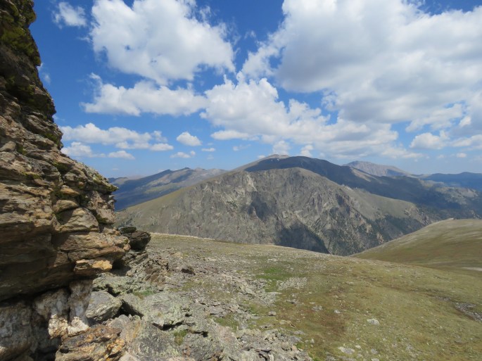
The Rocky Mountains form one of the world’s longest ranges, stretching almost unbroken from Alaska to south of the border. RMNP preserves a small but important section of the Rockies. The altitude is so high the growing season is only six weeks long. I have loved spending time in the Rockies this summer.
Colorado Springs
My next stop was Colorado Springs. Ralph and I visited the Springs a few years ago. I decided to stop halfway to the Great Sand Dunes and see a few of the sites I missed the first time around.
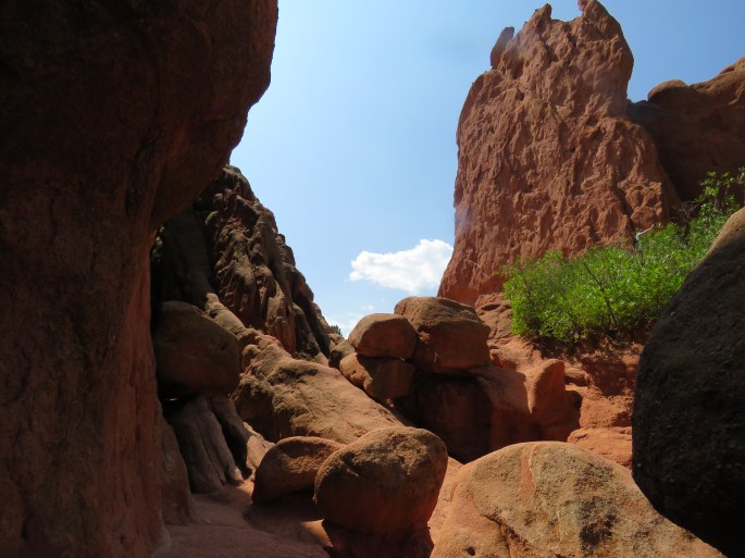
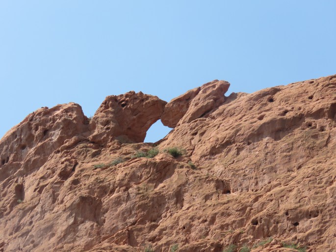
I was parked at the Elk’s Lodge and it was only a couple miles from the Garden of the Gods so I decided to revisit. It is a beautiful red rock area and a good place to hike.
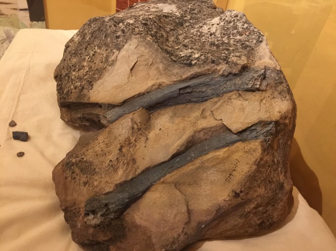
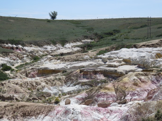
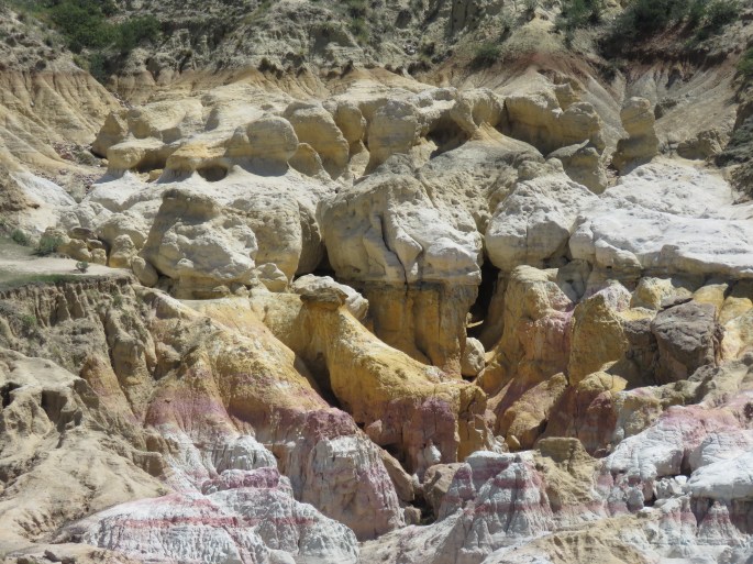
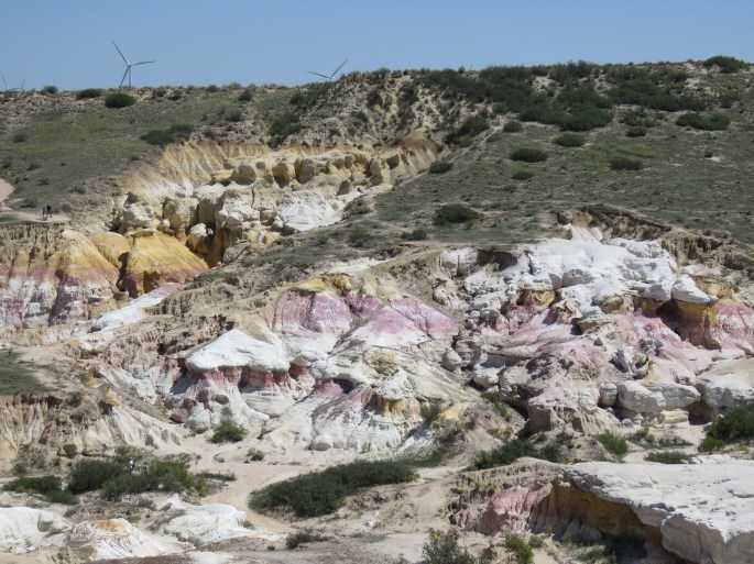
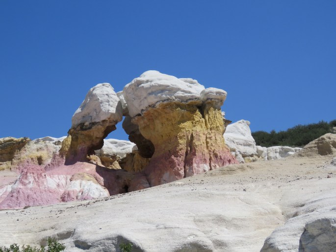
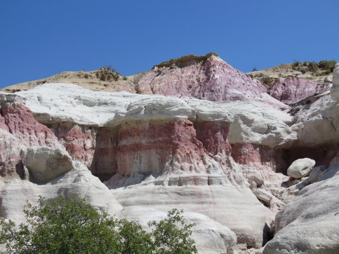
I drove the 30 miles to see the Calhan Paint Mines. According to Wikipedia, the Calhan Paint Mines is “a unique blending of geological, archaeological, historical and ecological resources”. What makes it unique is the grassland and geological formations of hoodoos, colored clay and sandstone-capped spires. Archaeological evidence, such as arrow heads and stone dart tips, has found that there was prehistoric and historic occupation by Native American peoples as early as about 9,000 years ago. The clay was used in prehistoric and historic times to create and paint pottery and as paint for ceremonial purposes.
Paint Mines
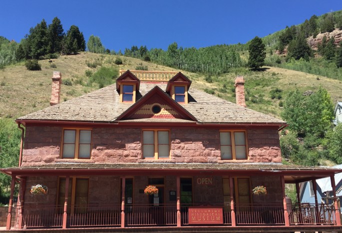
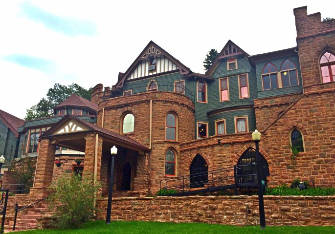
The small town of Manitou Springs is just a few miles west of the Springs. While I visited Manitou I toured the Miramont Castle. The castle was built in 1915 as a personal residence for Father Jean Baptiste Francolon and his mother. The castle changed hands eleven times before the Manitou Springs Historical Society purchased the building in 1976 and saved it from condemnation. It is a beautiful building to tour and acts as a museum on this history of Manitou Springs. Manitou Springs is also where you can get the cog train up to the top of Pike’s Peak.
Walsenburg
I have a love affair with sand dunes. Therefore, I could not pass up the Great Sand Dunes National Park about 60 miles west of Walsenburg. I parked at Lathrup Lake State Park just off I25. It was a really nice state park with electric and water hookups. The sites have a lot of privacy. It was only the camp host and me for most of my stay. Nice and quiet.
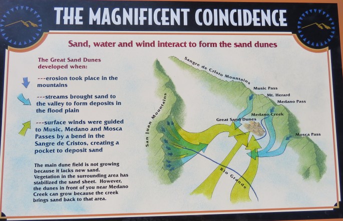
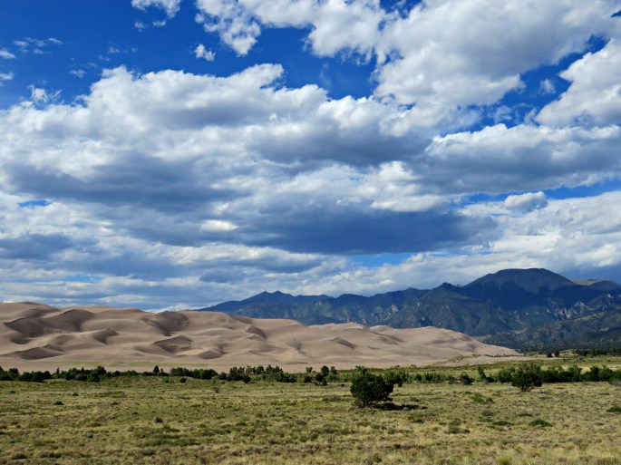
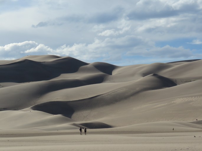
It was a beautiful drive to the Great Sand Dunes and the weather was nearly perfect. I understand it can be very windy through the area. The Dunes are nestled against the rugged Sangre de Cristo Mountains, and are North America’s tallest dunes. The dunes formed by eroded mountains, then shattered by freezing and thawing, and tumbled by streams and winds. I did not hike to the top of the dunes. It takes a couple hours to hike to the highest dune and I didn’t arrive until 4:00 pm. I wanted to get there when the light was right to photograph the dunes. I’m so happy I took the time to visit. I will also visit the White Sand Dunes Park in New Mexico.
Highway of Legends and San Luis Valley
In the late 1800s, while much of the state mined gold and silver, the southeast region mined coal. Linked with this region are many legends and folklore. Such as the lost gold vein with nuggets so big, one nugget could provide enough wealth to live for a year. There is also the story of George Simpson who saved Trinidad from an attack from the Ute Indians by distracting them with taunts. You can explore these legends by traveling the Highway of Legends byway. Beginning in Trinidad, you can follow the Cucharas River, traveling through Cokedale, Cuchara, La Veta, and end in Walsenburg. The byway is usually open all year and is 82 miles long. From the byway, you can see views of the Spanish Peaks as you travel through the San Isabel National Forest. The Sandstone walls of Stonewall also decorate the area, giving a Spanish appearance. The dikes of the Spanish Peaks protrude from the sandstone walls. Here, the ancient legend of the Devil’s Stairs was born. Long ago, the Devil came out from hell to survey the world, choosing the Cuchara Velley as his entrance. He would climb the steps and sit on the twin mountains (Spanish Peaks), plotting how to make it his. God learned of this, and noticing the beauty of the mountains and valley, took it as his own. He forbade the Devil to ever enter the area again, but the Devil’s steps still stand. It was a beautiful drive and I kept thinking what a great motorcycle ride it would be.
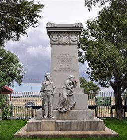
Ludlow Massacre Monument
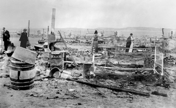
Being the Union supporter that I am, when I heard about the Ludlow Massacre I was very interested. The massacre emanated out of a labor conflict. According to Wikipedia, the Colorado National Guard and Colorado Fuel and Iron Company guards attacked a tent colony of 1,200 hapless striking coal miners and their families at Ludlow, Colorado, on April 20, 1914, with the National Guard using machine guns to fire into the colony. About two dozen people, including miners’ wives and children, were killed. The chief owner of the mine, John D. Rockefeller, Jr., was widely criticized for having orchestrated the massacre.
The massacre, the seminal event in the Colorado Coal Wars, resulted in the deaths of an estimated 25 people, although accounts vary. Ludlow was the deadliest single incident in the southern Colorado Coal Strike, which lasted from September 1913 through December 1914. The strike was organized by the miners against coal mining companies in Colorado. The miners striked because of the dangerous, deplorable, working conditions. They were paid In “company money” and could only spend it at company stores.
In retaliation for the massacre at Ludlow, the miners armed themselves and attacked dozens of anti-union establishments over the next ten days, destroying property and engaging in several skirmishes with the Colorado National Guard along a 40-mile front from Trinidad to Walsenburg. An estimated total of 69 to 199 deaths occurred during the entire strike. It was described it as the “deadliest strike in the history of the United States”, and it is commonly referred to as the Colorado Coalfield War.
The Ludlow Massacre was a watershed moment in American labor relations. Historian Howard Zinn described this as “the culminating act of perhaps the most violent struggle between corporate power and laboring men in American history”. Congress responded to public outrage by directing the House Committee on Mines and Mining to investigate the events. Its report, published in 1915, was influential in promoting child labor laws and an eight-hour workday.
My time in Walsenburg was short but packed full of great activities.
My summer in Colorado came to an end. I have to say I think Colorado is my favorite state thus far. I love the Rocky Mountains and the way Colorado appreciates and preserves their history. And, people in Colorado really love the outdoors. I hope to come back some day in the future.
Now it’s time to move south to New Mexico and a bucket list item for me; the Albuquerque Balloon Fiesta. I’ve been trying to get there for three years and I’m going to make it this year!
Till the next time…