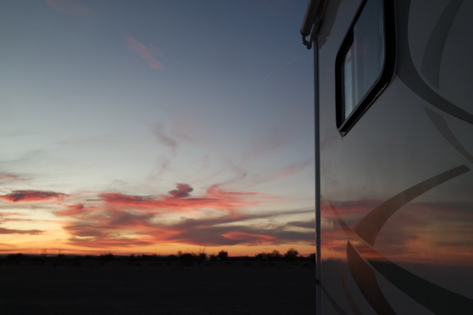
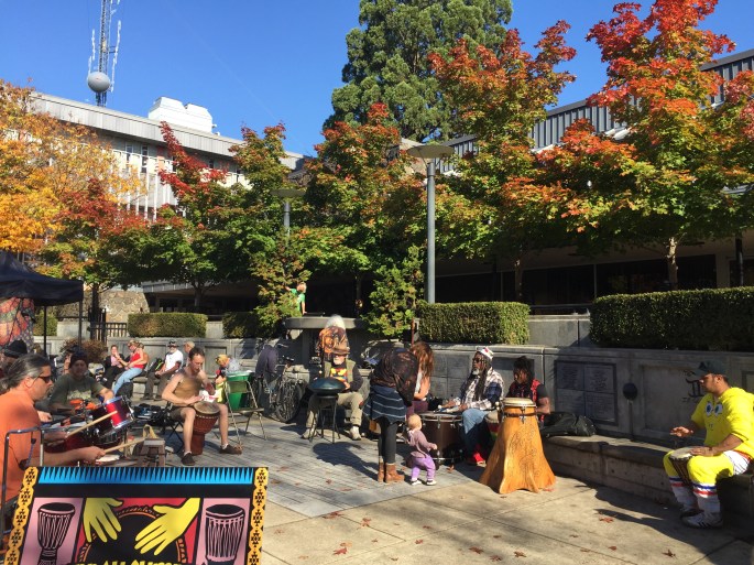
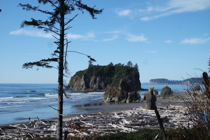
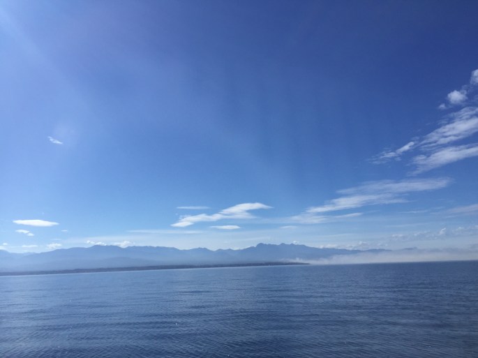
I seem to be drawn to Arizona. Yet again this year I stayed longer than I planned. I was in Tucson until April 30 when I headed to the Grand Canyon and Monument Valley with an overnight stay in Rock Springs, Arizona. I’m caravanning with my friend, Malia (Malia’s Miles blog).
Our first stop was the Rock Springs Café. We found a great boondocking spot in their event parking lot north of the restaurant. Rock Springs Café is known for their delicious pies. It was Malia’s birthday and she got a free piece of pie and free beer! It was a small oasis in the desert and a great place to spend the night. Rock Springs was half way to the Grand Canyon.
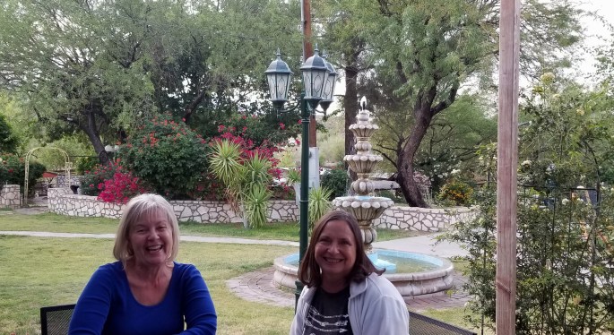
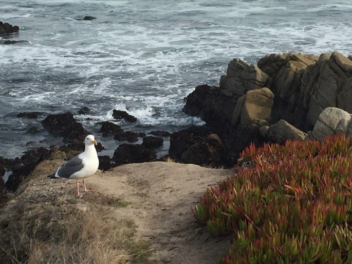
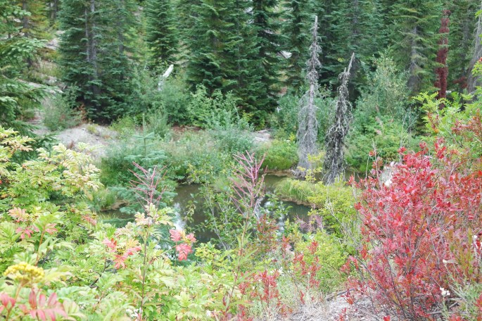
Rock Springs Garden Area – Malia’s Birthday
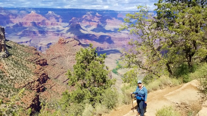
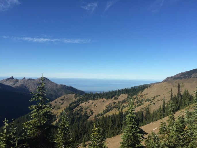
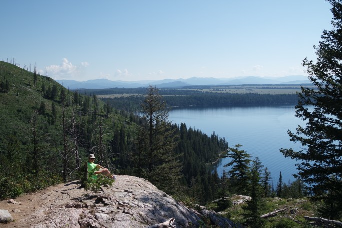
The next morning we left for the Grand Canyon and found a beautiful boondocking spot on forest road 688 just 10 minutes south of the south entrance to the Grand Canyon. We settled in for the evening and were very excited to visit the Grand Canyon (south rim) the next day.
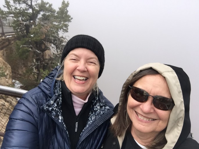
I woke up the next morning about 5:30 and looked out the window and much to my shock and excitement there was four inches of snow covering everything! You know I’ve been gone from Michigan a long time when I get excited about snow. The snow stuck to everything except the road. It was a very foggy day, which helped keep the snow around for a while and it was completely gone within 12 hours.
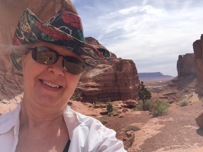
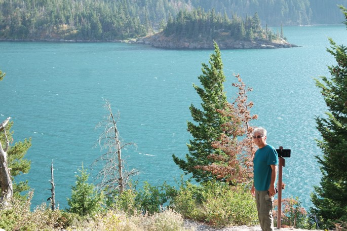
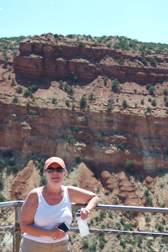
That’s me on the left
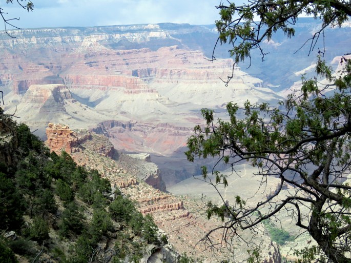
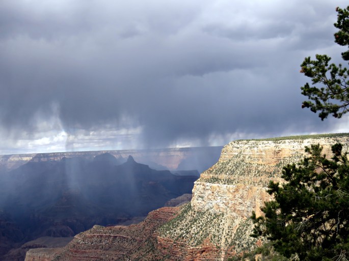
Even though it was pretty cold (45 degrees) we decided to head to the Grand Canyon wondering if we’d see a layer of snow in the canyon. We were very surprised to see the canyon totally covered by fog. Both of us had seen the canyon before and knew what to expect. When we couldn’t see anything we both burst out laughing. I felt sorry for those there just for the day. We knew we were returning the next day so weren’t upset at all. So plan B…we went to the IMAX theatre and watched the Grand Canyon movie. It had been a very interesting day with a couple surprises. I do like days like that!
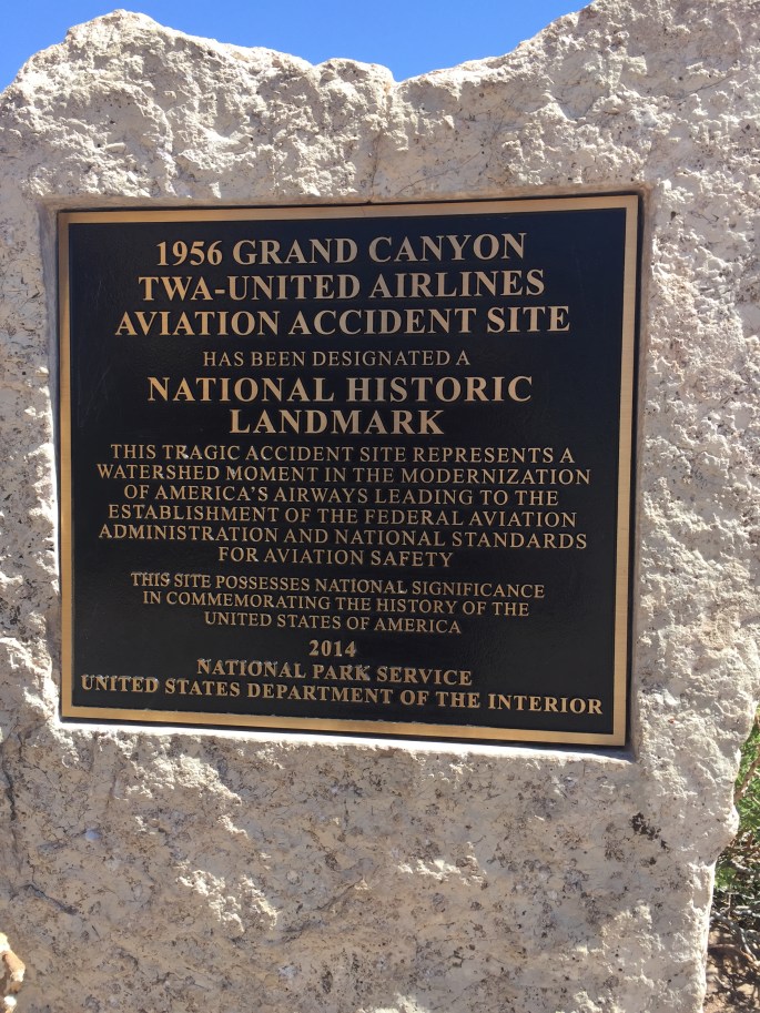
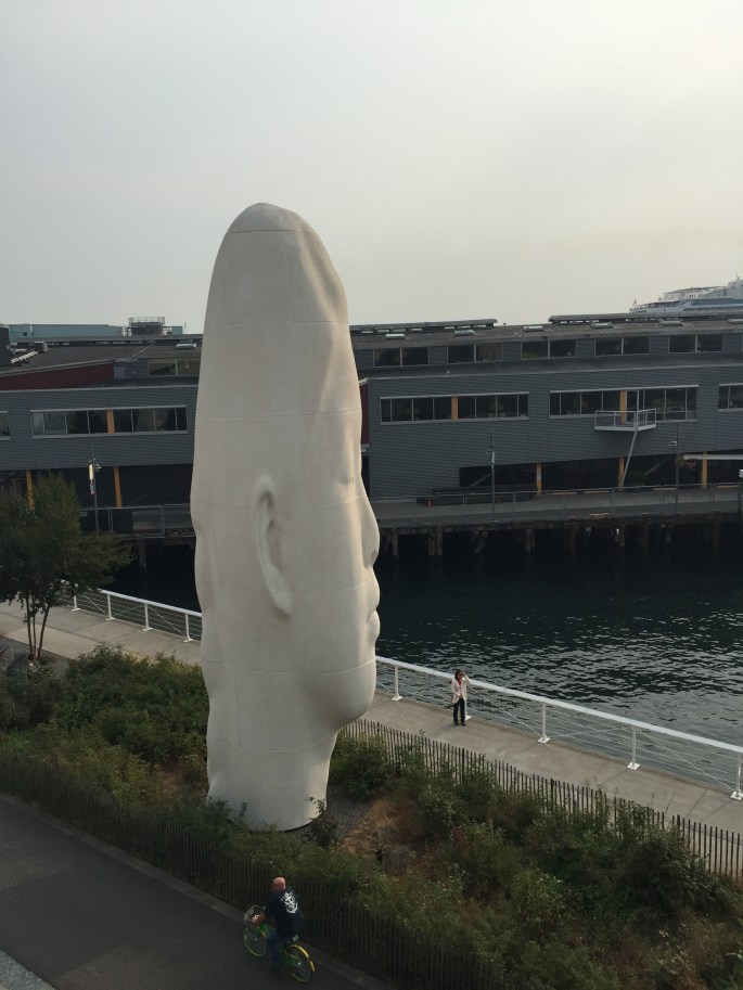
That’s the Grand Canyon behind us!The towerAirplane crash over the Grand Canyon
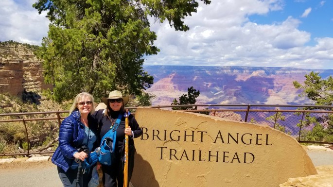
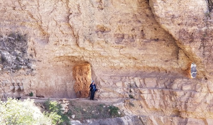
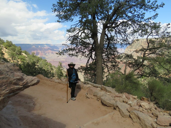
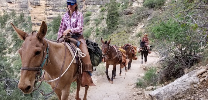
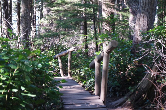
The next day was perfect weather and we hiked the Bright Angel trail for a couple miles. We stopped into the lodge for a cocktail and snack before heading back to camp.
Bright Angel Trail The first tunnel on the Bright Angel trail
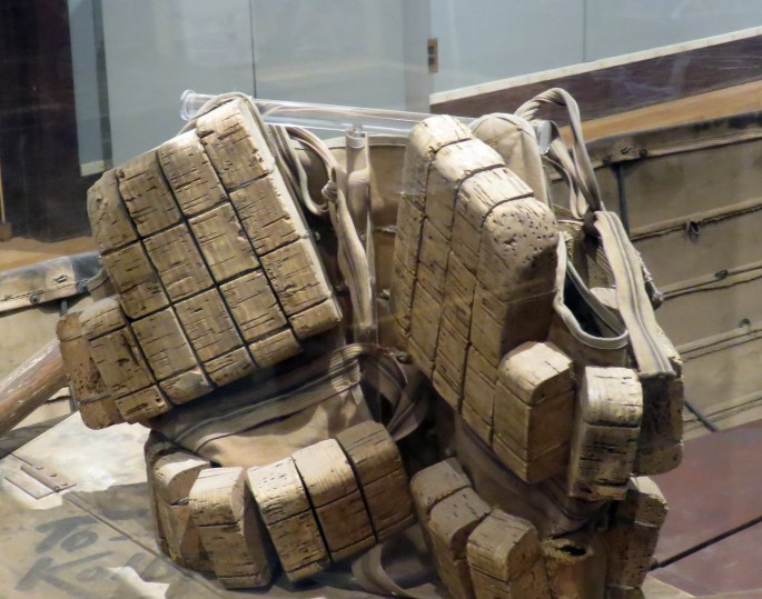
Malia on Bright AngelJust a big hole in the ground! Ha!Fireplace made with the same layers of rock as the canyonLooking down on the Bright Angel trailSharing the trail Life vest made from cork
And then the rain blew in
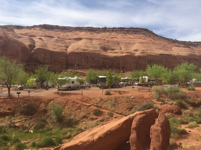
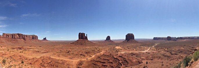
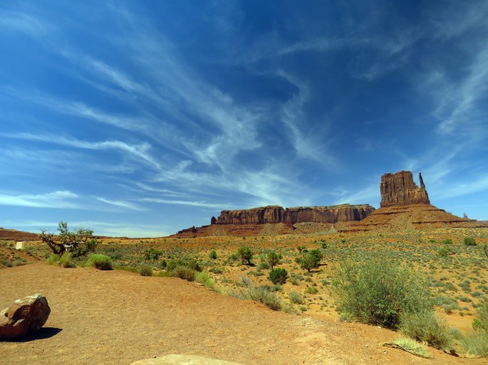
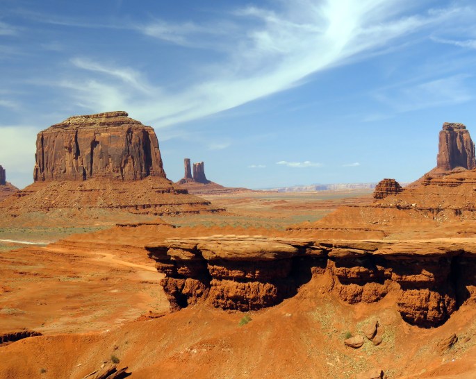
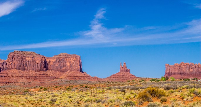
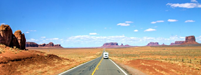
Then it was off to Monument Valley, a bucket list item for me. I was not disappointed! We stayed at Goulding’s RV Resort nestled among the red rocks. Goulding’s Resort started years ago to support the movie industry in the area. They have a small movie museum that is worth a visit.
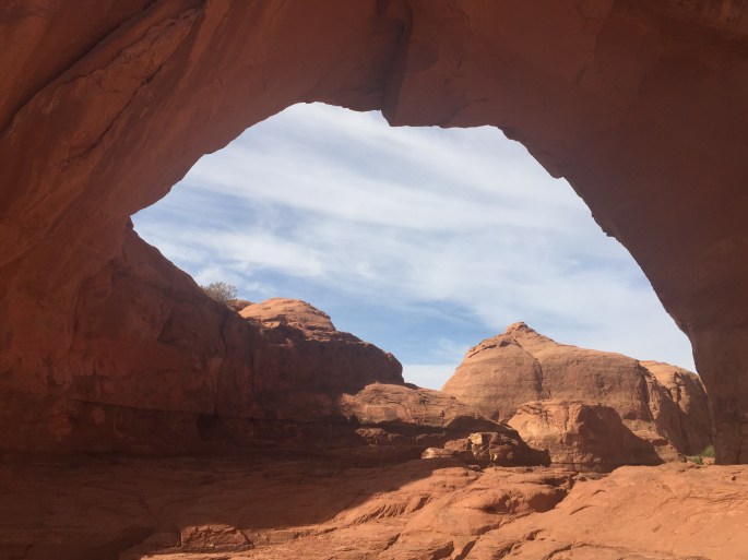
Goulding’s RV Park (that’s me on the left) Trail from the RV parkTrail leads to a red rock arch
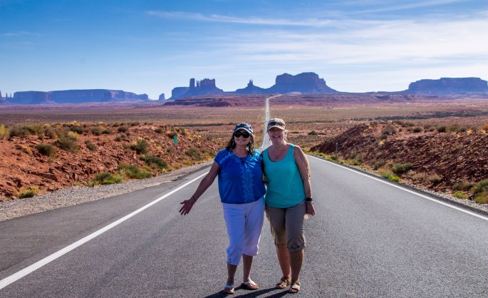
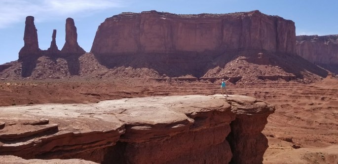
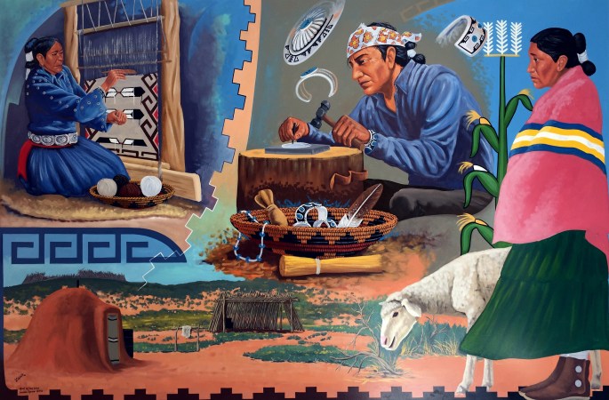
The Monument Valley in part of the Navajo Reservation. You can take guided tours of the area, but we chose to take our own car and drive the Valley Road. That let us get down and among the mesas, buttes and spires. The weather was perfect. There are stops along the road with Navajo vendors for art, rugs and jewelry. Of course, we had to stimulate the economy and purchased a few beautiful items.
Monument ValleyMonument ValleyMonument ValleyMonument ValleyUs on the Forrest Gump roadI made it to Monument Valley !
Wall painting in the visitor center
Our time in Monument Valley was short and very impressive. I’m so happy that I finally made it there.
Our next stop is Durango, Colorado where I will spend a month exploring the area.
I keep returning to a boondocking area just 17 miles west of Yuma, technically in Winterhaven, California. The BLM area is near the Ogilby exit off Interstate 8 on Sidewinder Road. This was my fourth time camping on Sidewinder. Sometimes alone and sometimes with friends. Ralph, Mick and Deb were with me as we killed time before heading up to Quartzsite to meet up with other friends and attend the big RV rally. Deb and I visited the Imperial Sand Dunes and took a few photos. I LOVE sand dunes. I don’t know why…I just do.
Imperial Sand Dunes
Imperial Sand Dunes
Deb
Deb and me
Old Plank Road
My nephew and his family, Kevin, Mariya, Mason and Kyle, came to visit and roast weenies.
Mason, 5 years oldKyle, 1 year old
Quartzsite
When we arrived in Quartzsite we found a fairly flat area in the Dome Rock section about five miles west of Quartzsite. I like to camp here because it is elevated and has great views of the Quartzsite lights at night. You can see the sunrise and sunset right from this location and it is much quieter than camping in Quartzsite.
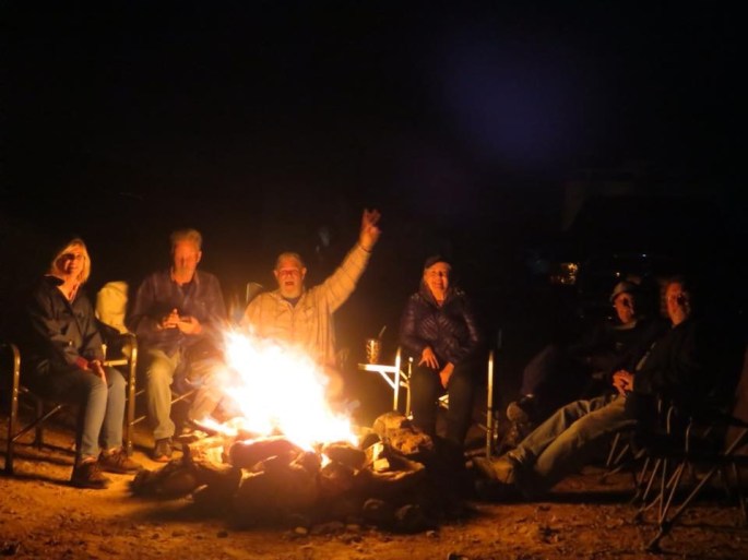
Eventually there were five rigs: Deb and Mick, Cheryl and Jesse, John and Bill, Ralph and I, and one of my bookies, Lynn, who was on her maiden voyage with her new rig. John brought a LOT of firewood and we had a campfire every night and even some mornings. We all spent money at the RV Big Tent, went to the Desert Bar, looked for unique rocks and had a great time with wonderful friends.
That’s a “Mick” fire. Those of you who know him will understand! 🙂
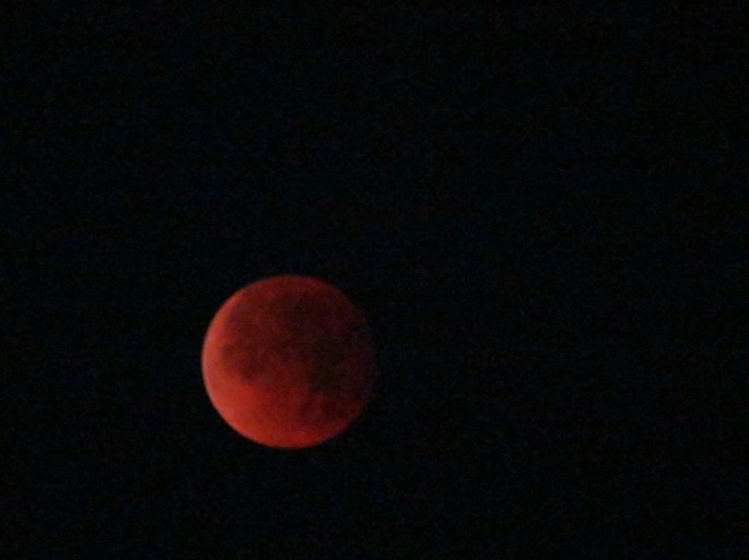
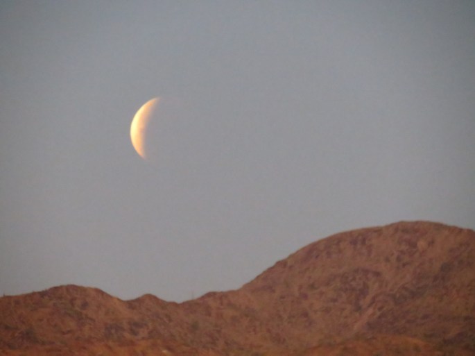
The frosting on the cake was the Blue Moon/Red Moon and total lunar eclipse. We got up at 5 am to catch the eclipse and also had a campfire and watched the sunrise. What a unique experience! Deb took some wonderful pictures.
Blood Moon, Lunar EclipseLunar Eclipse
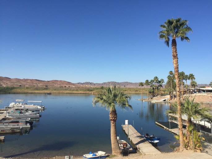
We stayed two weeks and it went so quickly. Ralph hitched a ride back to Sacramento with Cheryl and Jesse, while Lynn and I headed to Martinez Lake to join a few of the Escapee’s Solos for the week.
Martinez Lake
Martinez Lake is about 10 miles north of Yuma on the Colorado River. Being near water in Southern Arizona is a rare treat. Several Escapee Solos were also camped there, so we had a built-in social group. Lynn did some work on her rig and Fred and I just hung out and visited.
Martinez Lake
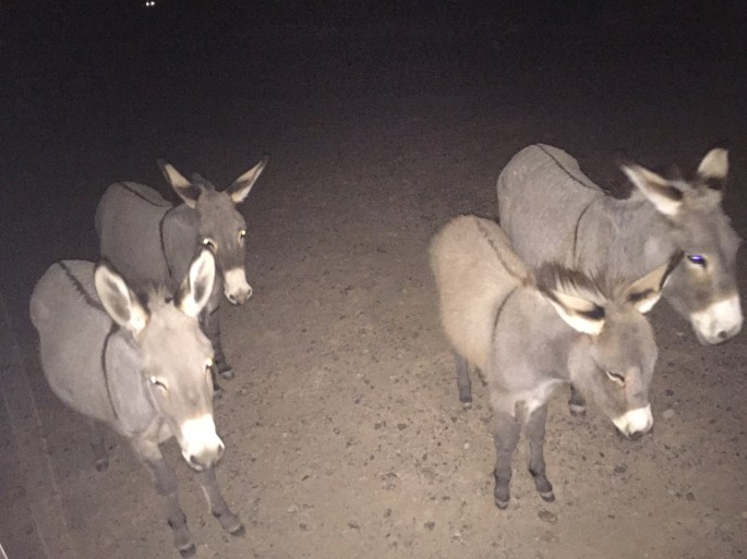
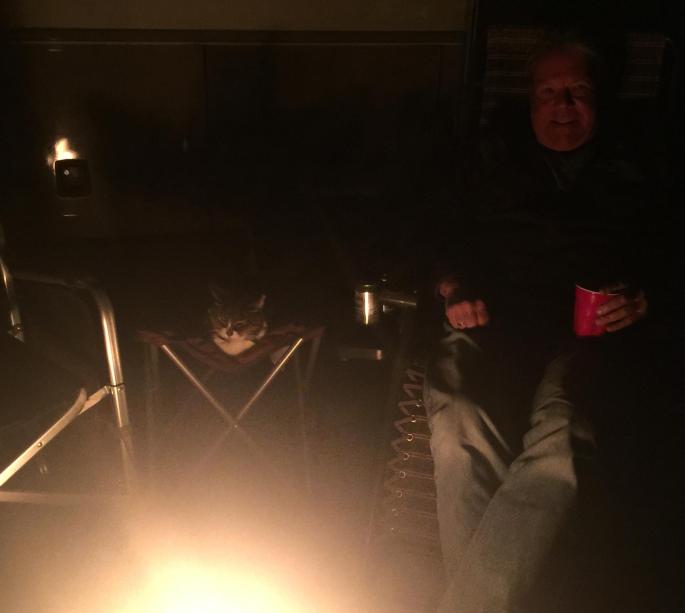
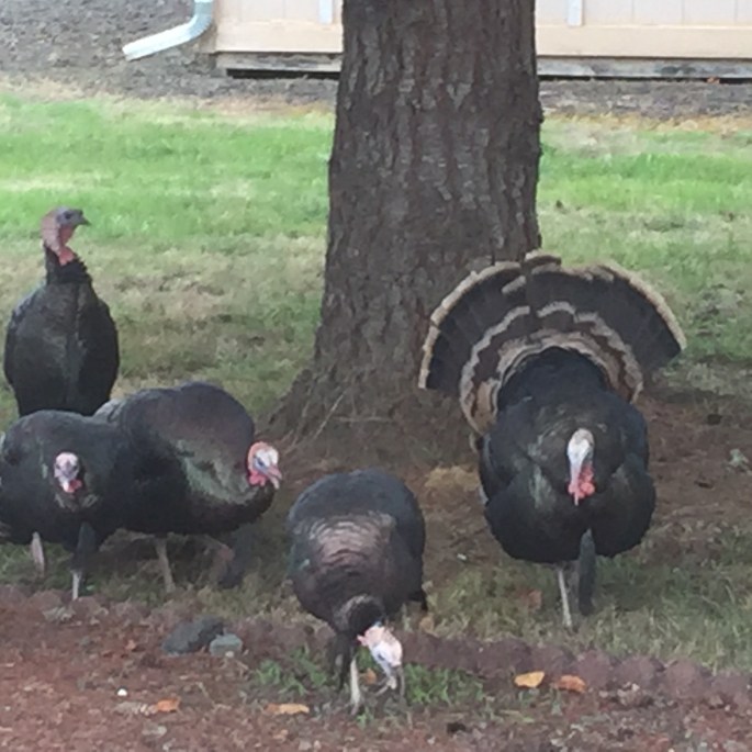
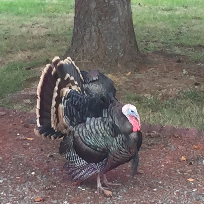
I had visitors every evening right after dusk. Fred just watched them through the window. I doubt he’d ever seen anything like this before.
So cute and friendly. I didn’t dare feed them. They would never leave!
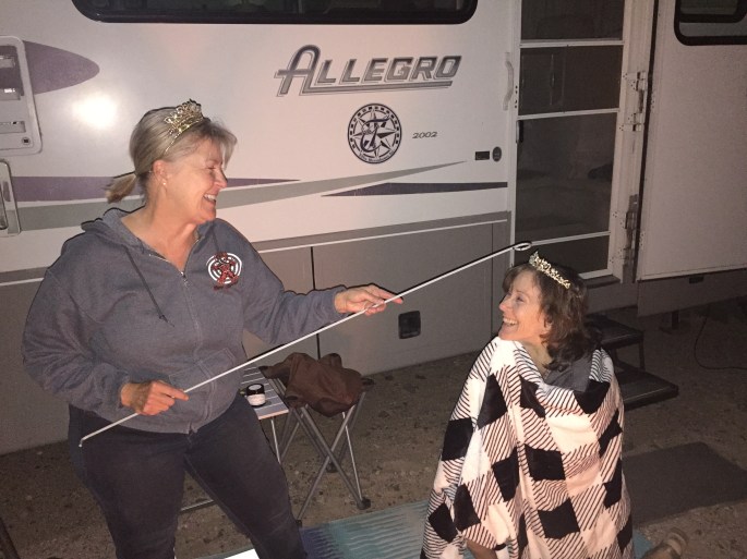
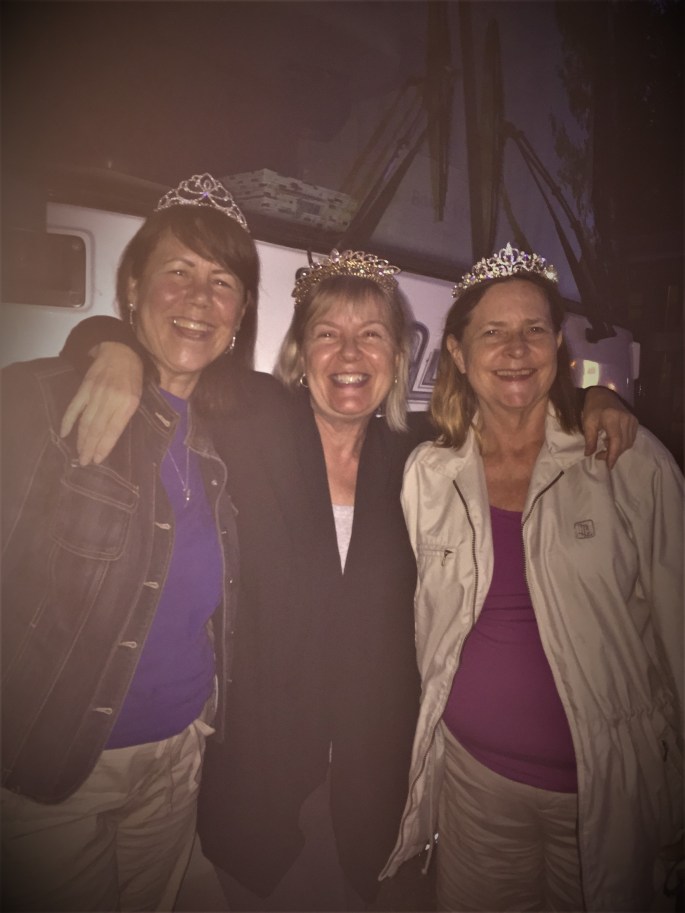
I also crowned another Road Queen; my friend Lynn.
The newest Road Queen, Lynn
Freddy and Owen by the campfire
I was just getting ready to head to Tucson and spend a couple weeks with my friend Malia (Malia’s Miles blog) when I came down with the Shingles! UGHHHHHH! What a nightmare! First I had a lot of pain that I couldn’t explain and then the blisters broke out. That’s when I realized what was happening. I went to a walk-in clinic and started the anti-viral meds, which worked to stop the virus in its tracks. However, what was already there was bad enough. As of the date of writing this, I’ve had shingles for seven weeks. The blisters are gone, but, I still have a lot of nerve pain. I sure hope it goes away soon!
Instead of heading to Tucson, I went to my nephew Kevin’s house and parked in front of his house for another week. I stayed until I felt like I could handle the 240-mile drive to Tucson. Kevin and Mariya took good care of me and I had a chance to spend more time with the little ones. Baby Kyle is one year old already.
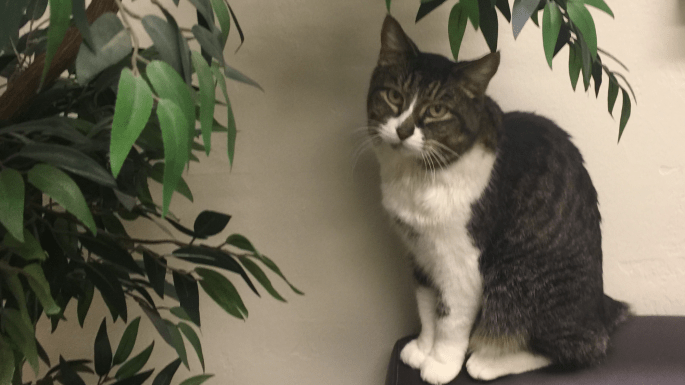
While in Yuma I took Fred to the vet for vaccinations, where they discovered that Fred needed a couple of teeth surgically removed. Little did I know that this would be the beginning of the end for our little buddy, Freddy the Freeloader.
Tucson
My original plan was to spend two weeks in Tucson with my friend Malia and then fly out of Phoenix to Florida to visit family. However, after making the drive to Tucson it was clear that I was in no condition to travel to Florida, so I canceled my trip. On top of feeling terrible, Fred was going to need surgery for his teeth. Ralph decided to fly to Tucson to help Fred and me. I was soooo grateful. I had no idea what lie ahead for Fred.
We found a vet in Tucson and went in to have the pre-surgery blood tests complete. This would tell us if Fred was healthy enough to survive the surgery. When the vet opened the door he said, “I don’t have good news for you.”, my heart sank. He informed us that Fred’s kidneys were failing and he could not perform the surgery. He advised us to administer sub-cutaneous fluids for 14 days and return for another blood test. Maybe this time he would be healthy enough to survive the surgery. After a few days of the fluids, Fred was a new cat! He wasn’t sleeping the entire day, was very playful and wanted to go outside all the time. I was so hopeful.
When Ralph and Fred met up with me in Oregon, I noticed how much weight Fred had lost. He was also drinking much more water and peeing a lot. After Ralph left at the end of January, it was just Fred and me. I could tell he just wasn’t himself. He was hiding in the back of the rig, sleeping all the time and even vomited. I now believe that his body was full of toxins because his kidneys were not working and he was close to death.
The vet told us that 65% of old cats die from kidney failure. It was a surprise to us that Fred was an “old cat”. Since he adopted us, we didn’t know how old he was. We thought 7-8 years old. The vet told us he was 11-12. We lost 5 years with Fred overnight! We also learned there is nothing that can be done to reverse or even stop the kidney failure. Fred only had about 6 months to live and that’s if I gave him the sub-q fluids every day. Ralph was leaving for Oregon to continue his house hunt and there was no way I could handle that by myself. I couldn’t watch Fred die over the next six months, so we had to let our little Freddy go. It broke our hearts and I cried for two days straight. I cry every time I see his ghost in the spots where he always slept and on the back of the dinette next to the frig where he would perch and wait to be fed. I miss his little face when he woke me up in the morning by touching his cold nose to my nose.
The last photo of Fred
Fred was a wonderful travelling buddy and a friendly, adaptable cat that everyone loved. Ralph said that Fred changed his mind about cats. I miss him so much.
After losing Fred we had to do something different.
Our friends Mick and Deb we were at the Escapees Park in Benson so we decided to join them for a week. It was only 51 miles and I knew Ralph would enjoy having someone to play with because all I was doing was lying around hurting and grieving. The Escapees Park in Benson is a great park. The sites are huge, the people are friendly and there are many activities. They even have a workshop with equipment for the men. Ralph was a hit with the ping-pong guys and shot pool in a couple of tournaments. Deb and I went to a beading class. Ralph and I even did some sightseeing and drove to Tombstone, Sierra Vista and Bisbee one day. It was nice to finally get out and do something.
Then it was time for Ralph to fly home. We drove back to Tucson and I parked at the Diamond J RV Park. I was finally going to get to spend a couple weeks with Malia.
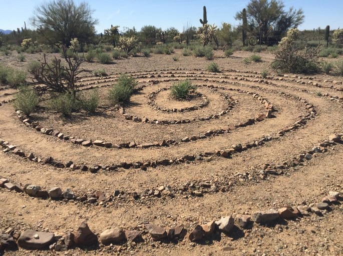
Lookin’ out my backdoor!Labyrinth in the desert
As of this writing, I’m still in Tucson and at some point I’ll head to Deming, New Mexico and begin my tour of the Land of Enchantment. I have Johnson relatives in Albuquerque and I am looking forward to spending some time with them.
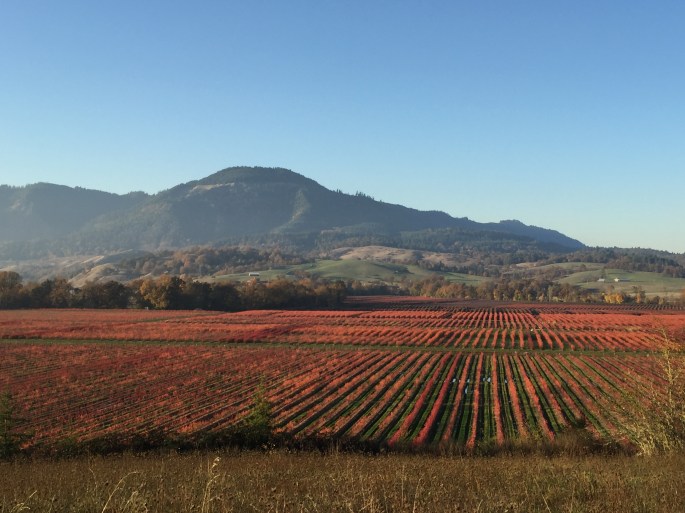
Continuing south on Interstate 5 from Medford, it was back to California. I had come full circle! The first stop was in Redding and a stay at the Redding Elk’s Lodge located on the Sacramento River. It was still Fall and Redding was putting on a very colorful show.
The River Walk in Redding
From Redding, it was only a three-hour drive to Sacramento. Ralph is still with me and we were lucky enough to stay at my book club friend’s ranchette in Wilton. This gave me a chance to take care of some health appointments, get my hair done, and go up to Saint Helena to celebrate Thanksgiving with friends. The friends that hosted Thanksgiving were in the Santa Rosa fire area. It’s a miracle their home and animals survived the fire when everything around them was destroyed. There was plenty to be thankful for on Thanksgiving.
The view from the rig in Wilton
While in Wilton I was able to get together with my bookies (book club girls), whom I hadn’t seen in nearly a year. It was actually great to be back in Sacramento and see friends.
Monterey
Soon it was time to leave the Sacramento area and drive the three hours to Monterey. Again, I stayed at the Monterey Elk’s Lodge. This was a great location from which to explore the area and go to the Monterey Bay aquarium. As luck would have it, friends Mick and Deb, who are also full timing, were in the area and we were able to spend some quality time together. We attended the boat parade and the Monterey Bay aquarium. I hadn’t been to the aquarium since my stepdaughter, Stephanie,
was about 12 years old. That was many years ago. I loved it then and I love it now. It is truly a remarkable aquarium. After visiting the aquarium, we had a delicious dinner on the wharf. This short video is the aquarium in motion.
Lover’s Point
Next stop was Pismo Beach and this time the Elk’s lodge was within walking distance to the beach. I’ve always loved the central coast and was happy to be exploring the area. I visited a loofa farm, downtown San Luis Obispo, and of course, spent time on the beach.
Pismo before the smoke camePismo after the smoke moved inA slightly smokey sunset
Did you know that loofas grow on plants? I did not. That is until I took a tour of the loofa farm! A loofa starts out as a gourd. What we recognize as a loofa is actually the inside of the dried gourd.
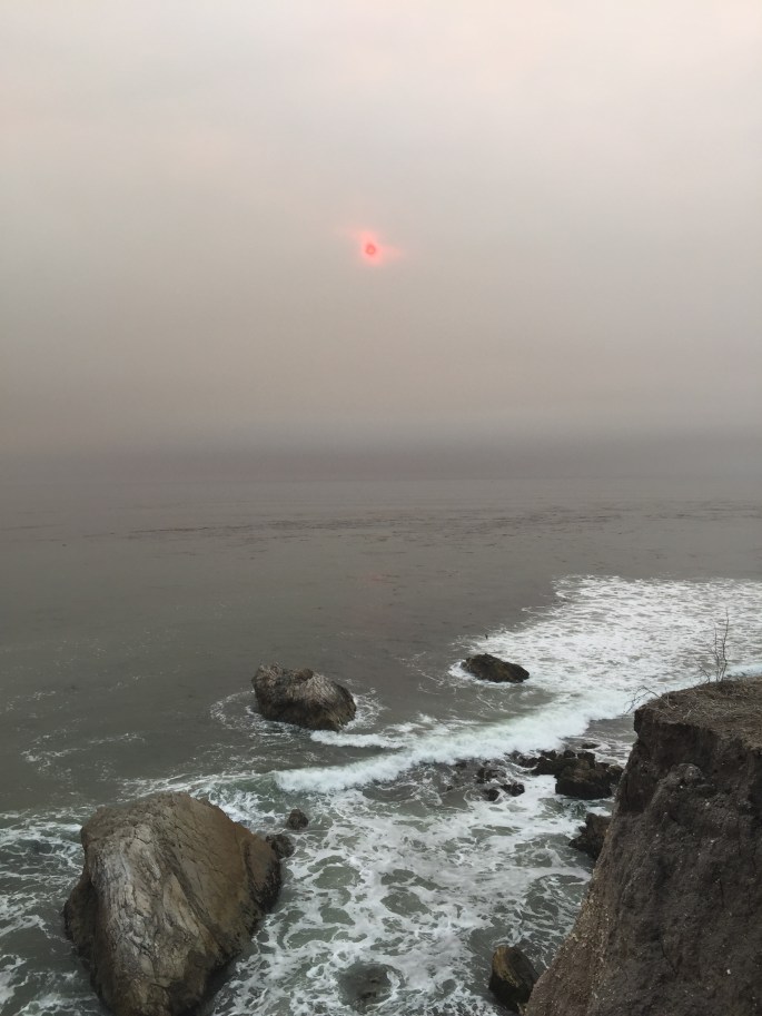
While in Pismo Beach the smoke from the fires in Los Angeles intruded. I certainly had my share of smoke in the Summer and Fall. First in Montana, then Idaho, then California.
Have you ever visited the gum wall in SLO? I have! Yuck!
Yes! That’s all chewed gum!
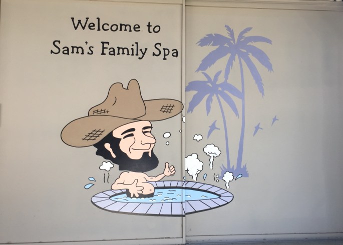
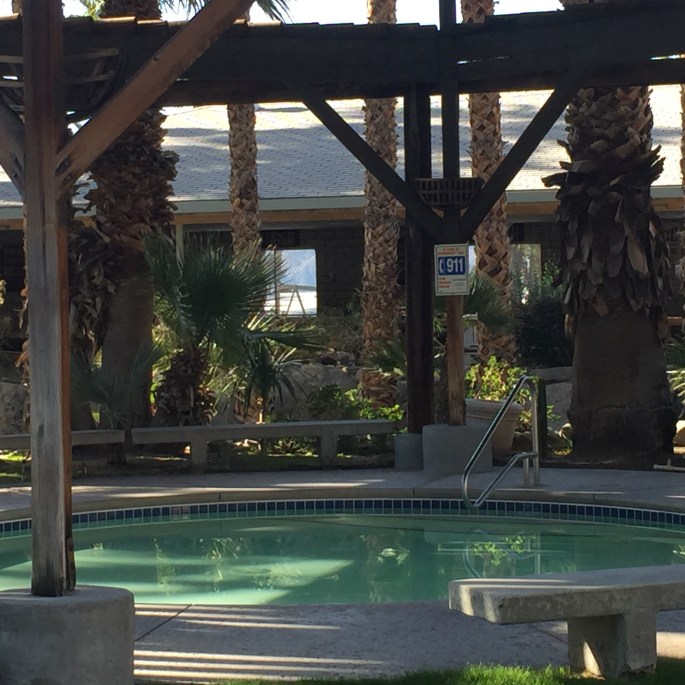
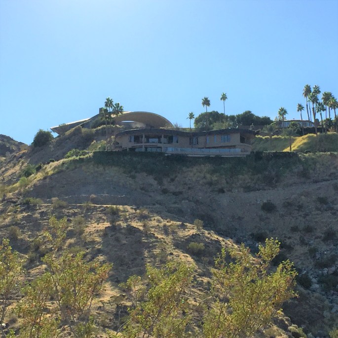
After Pismo Beach we headed to Desert Hot Springs for a week at Sam’s Family Spa. We took full advantage of the hot water spa. I drove into Palm Springs a few times to check it out. We also took a short hike that led to an overlook of Palm Springs and right beneath Bob Hope’s house.
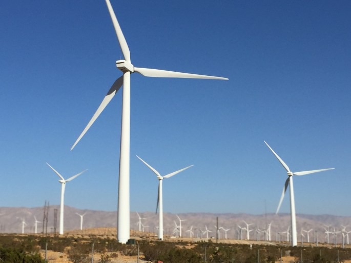
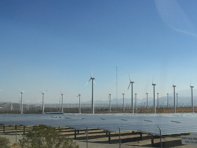
So proud of the use of renewable energy in California! Wind and solar here in Palm Springs.
Bob Hope’s house inn Palm Springs
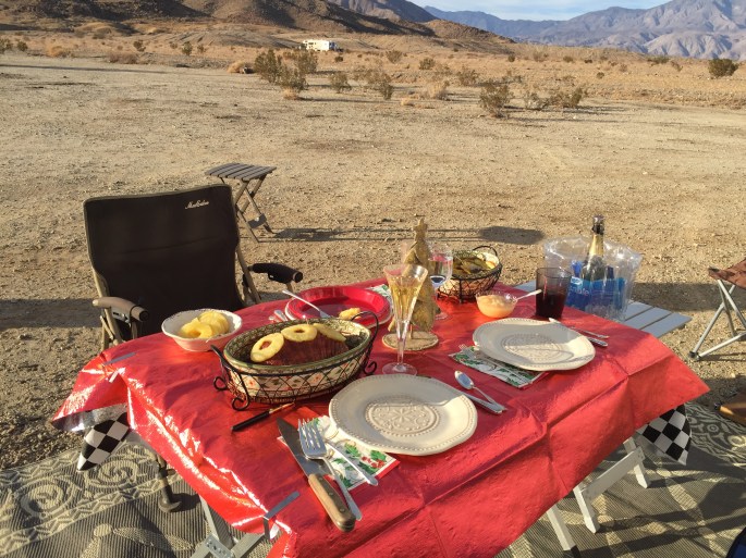
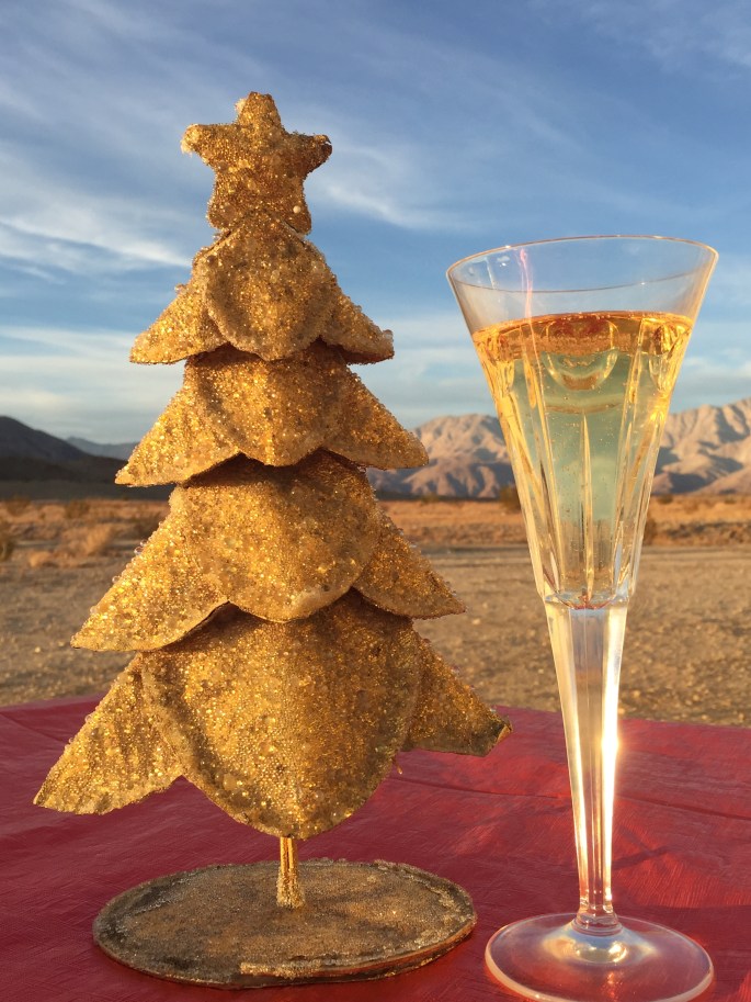
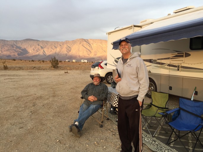
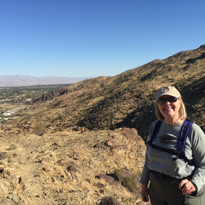
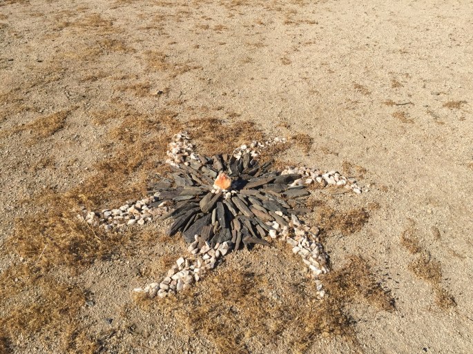
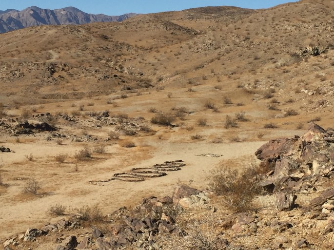
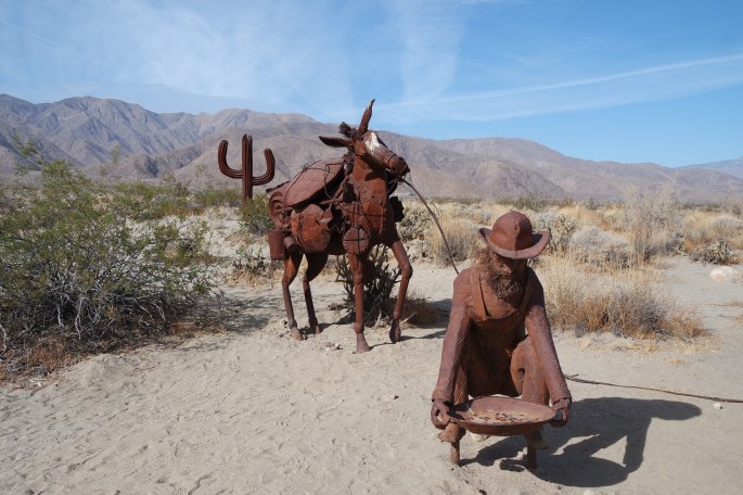
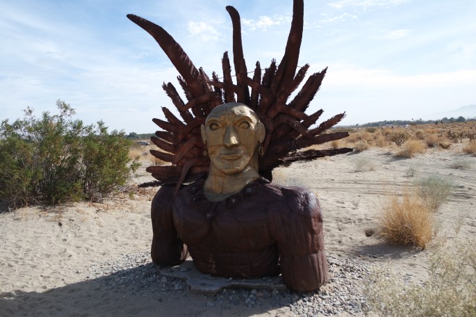
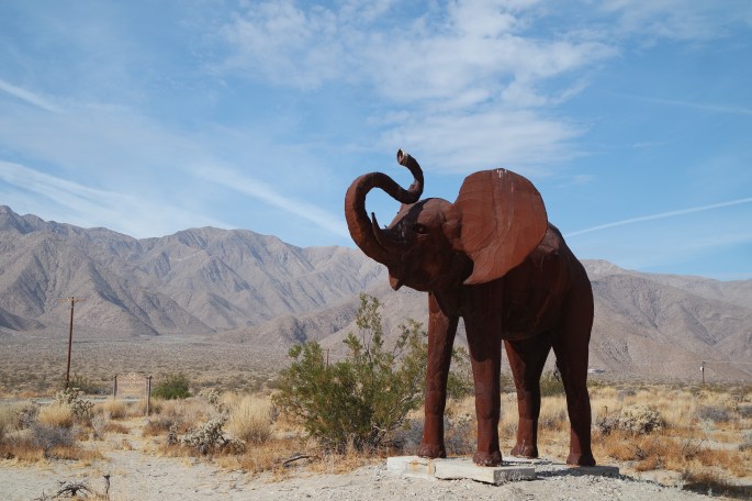
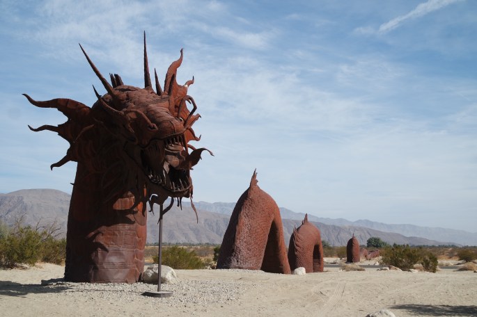
After our week in Desert Hot Springs we drove further south to Borrego Springs where we would spend Christmas and New Year’s boondocking in the desert with our friends Mick and Deb. We visited Borrego Springs a few years ago and it was nice to return to the area. This time I did a little more exploring, hiking, and discovering desert art.
Christmas Dinner in the desert
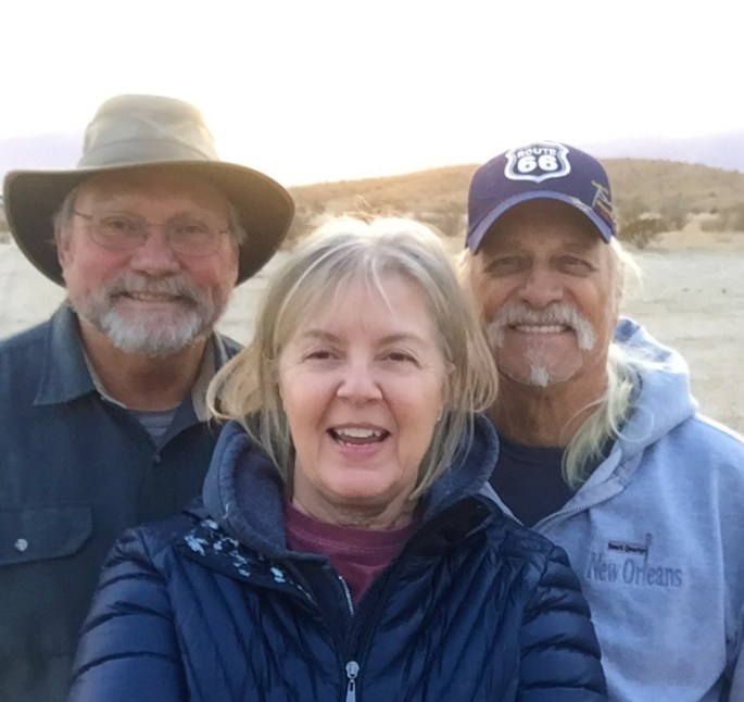
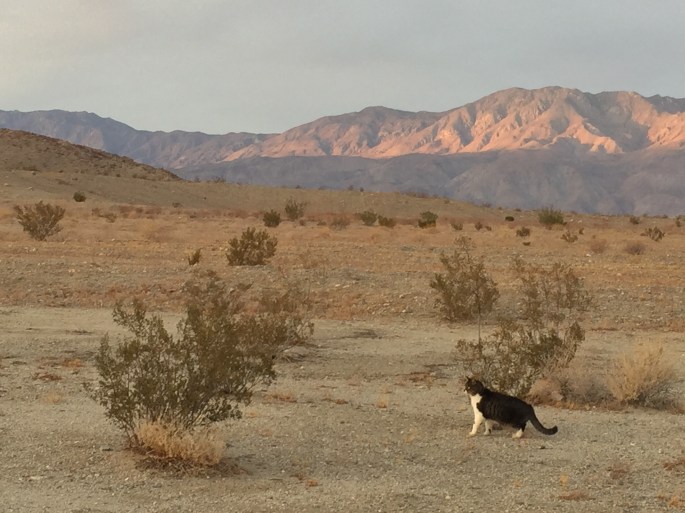
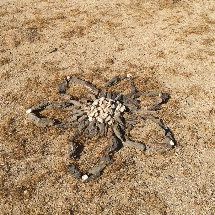
Christmas in Borrego SpringsChristmas selfie…Deb was sick.Freddy, my little desert hunterThe boys…just hangin!A little hike up and over the hill to discover the desert rock art.
And no trip to the desert is complete without a Roadrunner spotting!
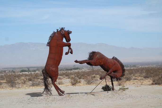
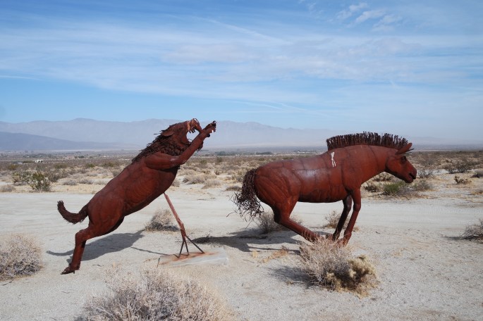
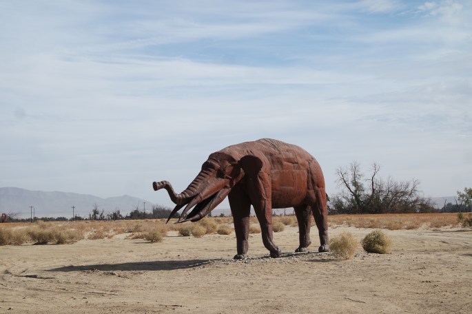
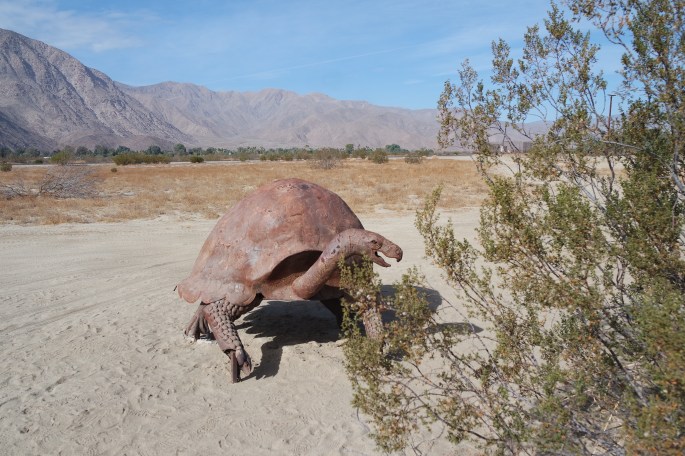
Ricardo Breceda large metal sculptures – 130 of them in the Borrego Springs area
This one crosses the road!
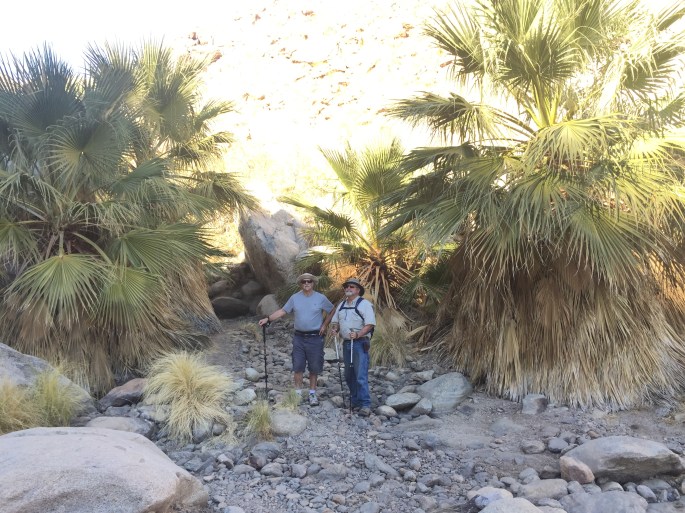
Hiking to the palm canyon
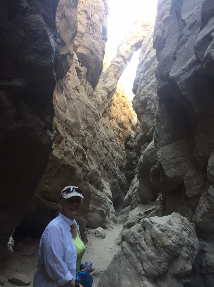
Slot Canyon Hiking
We stayed in Borrego springs until it was time to head to Quartzsite, Arizona for the big RV rally. Several friends from Sacramento met us in Quartzsite. Stay tuned…
I know it’s been awhile since my last post. I’ve been very busy, but I’ll try to catch up.
It took two hours to drive to the Vancouver/Portland area and the Elks Lodge. The lodge is located right next to I205 and it was like sleeping on the side of the freeway. It was the most noise I’ve experienced to date. I chose this Elks Lodge because it was close to my friend’s house.
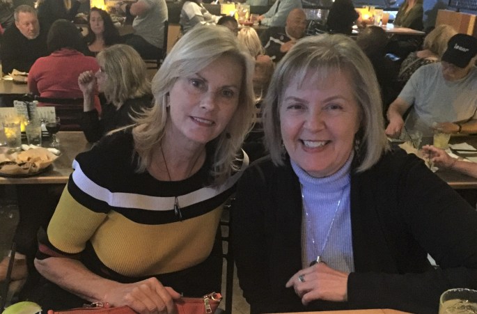
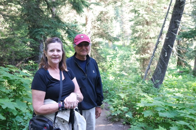
It was almost a near miss with my friend and fellow Michigander, Debbie, however, it did work out that we could spend the week together.
Debbie and I at dinner
We attended the Pompeii Exhibit, a Humane Society fundraiser and took in a movie. It was great to spend girlfriend time with a dear friend that I don’t get to see very often.
The Pompeii exhibit was so interesting. I knew that Pompeii was destroyed by a volcano eruption, but that was about it. Here’s what I learned.
In 79 AD Pompeii was a commercial port and strategic military and trading city. Forgotten after Mt Vesuvius erupted, the city was rediscovered about 250 years ago. The exhibit features around 200 artifacts including frescoes, mosaics and precious items belonging to the citizens of Pompeii. The items were well preserved under the volcanic ash. It was humbling to see ash body forms left behind as the volcano instantly covered everything in its path. Check out some of the photos.
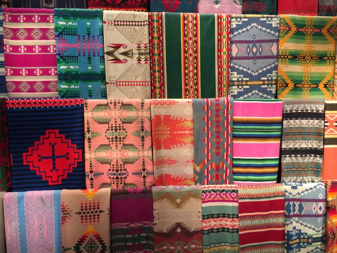
I also visited the Pendleton Factory and took the tour. I was a Clothing and Textiles major at Cass Tech so I found this extremely interesting.
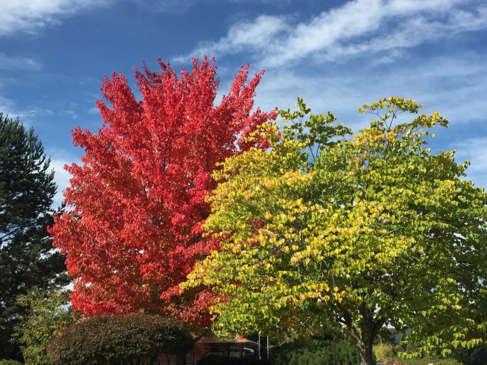
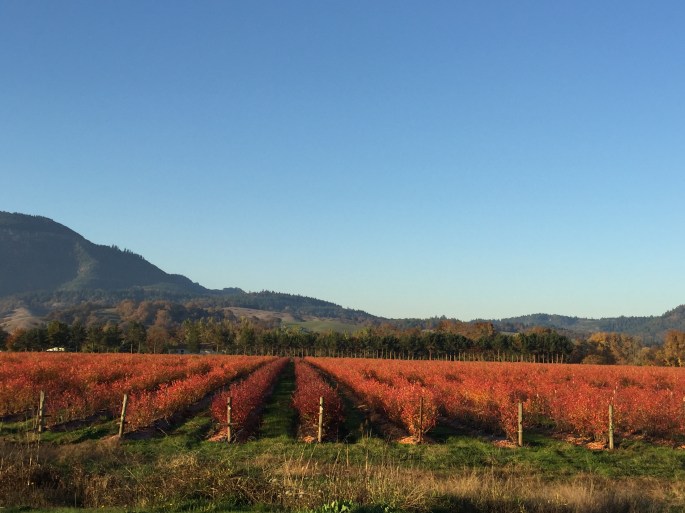
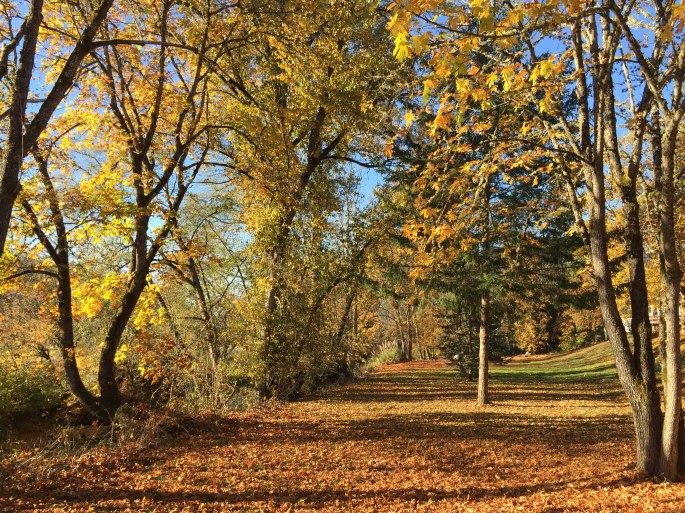
Deb was off to Japan and I moved down I5 to the Escapees park in Sutherlin to wait for Ralph to drive up from Sacramento. He sold his house and wants to buy a house in the Roseburg, Grants Pass or Medford area. It was a nice, quiet two weeks in Sutherlin enjoying the area and the brilliant fall colors. I got a daily visit by jack rabbits and turkeys.
While in Sutherlin I drove to the coast and visited Winchester and the Oregon Dunes State Park. I had been to both when we toured the Oregon Coast three years ago. It was a clear, sunny, warm day and I always love it when I have a chance to spend time by the ocean.
You can actually drive on the beach.
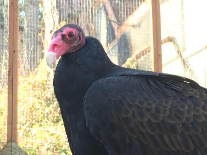
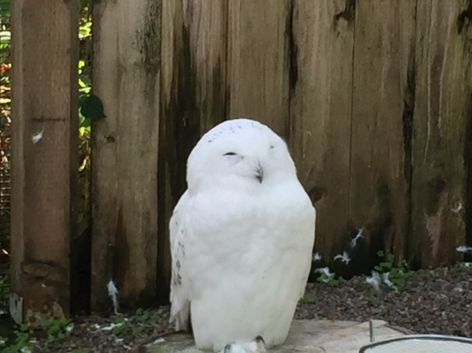
I drove north about 60 miles to Eugene for the Saturday Market. Eugene is a collage town with a great vibe. Hills and many trees with brilliant falls colors surrounded Eugene. I also visited the Cascades Raptor Center, a nature center and raptor rehabilitation center. The center is definitely worth a visit!
EagleEver seen a Turkey Vulture up close?Looks like a happy little owl!
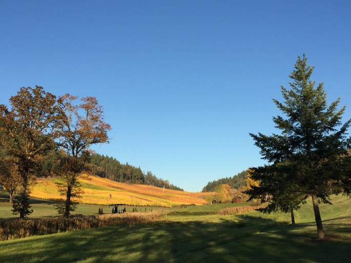
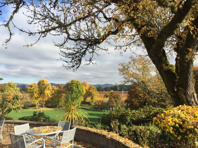
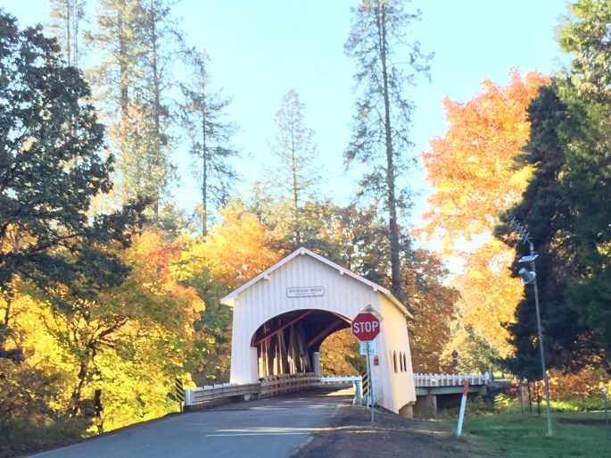
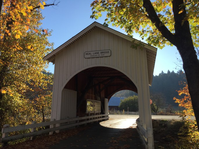
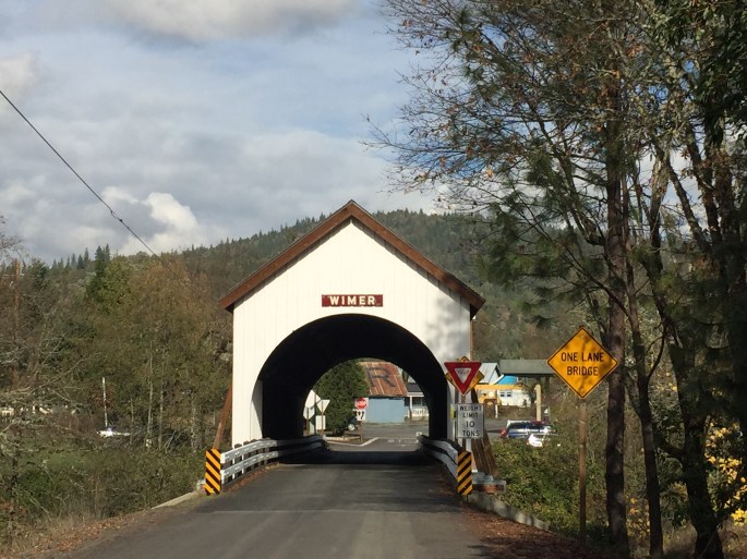
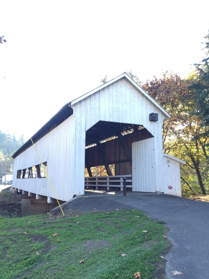
Once Ralph arrived, we looked around the Roseburg area. Roseburg is a small town on I5 surrounded by hills, rivers and farmland. The Melrose wine region has surprisingly good wine. And there are many covered bridges in southern Oregon.
Ralph didn’t find a house on this trip so we headed further south on I5 to the Rouge River State Park. It was the perfect spot from which to check out Grant’s Pass, Eagle Point and Medford and the house search continued.
Ralph and I have friends that moved to the Medford area. I was able to see two long-time friends Mary Joe and Alana, both Bay Area women I met when I first moved to California in 1979. Love spending time with my girls!
The newest Furtah, Eloise, with my nephew Michael and his wife Lauren
Since Ralph didn’t find a house, I invited Ralph to join me as I moved my way south through California.
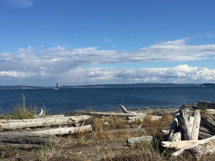
It was a short, beautiful drive from Shelton to Port Townsend along the Hood Canal. Port Townsend is an historic town (population 9,113) located at the northeast tip of the Olympic Peninsula, known for its natural beauty and Victorian buildings remaining from its late 19-century heyday. Established in 1851, the founders called it the “City of Dreams” because of early speculation that the city would become the largest harbor on the west coast of the United States. That dream did not come true. Port Townsend is surrounded by the Puget Sound and it reminded me of the small New England seaport towns in the eastern U.S. I found myself saying, “I could live here….in the summer!”
Port Townsend Victorian architecture
Port Townsend from the water
The Port Townsend Elks Lodge is one of the few that takes reservations and I was lucky to get a reservation two days in advance. When I arrived, the campground was fully booked. The lodge is only three miles from the historic section of town and is very popular.
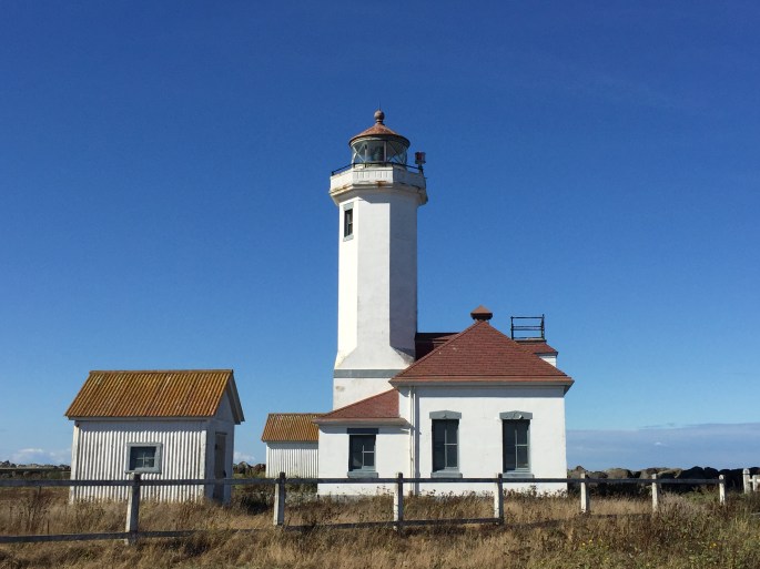
Fort Worden Historical State Park was the first place I visited. The park is a 434 acre multi-use park with more than two miles of saltwater shoreline and the Point Wilson lighthouse. I returned to the park several times during my week stay. It was peaceful, the weather was perfect and I could walk the shoreline along the Puget Sound.
Fort Worden BeachPoint Wilson Lighthouse
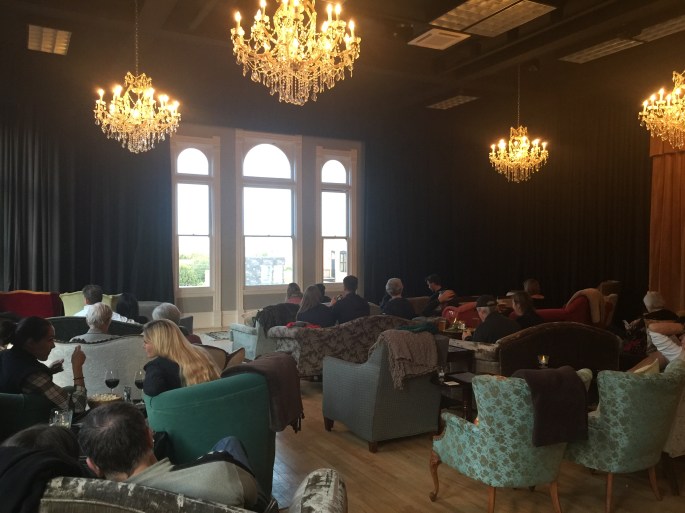
There are many things to do in Port Townsend. The old town area has restaurants, galleries, shops and bars. The historic Ruby Theatre shows movies and I saw Ingrid Goes West. The story was about social media breaking bad. It was funny, a little scary and very entertaining. The best part was the seating configuration and the availability of great food and drinks while you watch the movie.
Easy chairs and comfy sofas for the movie. The screen came down over the windows. Great food and drink delivered to your chair. Now that’s how to watch a movie!
I visited an Art Deco Lighting Museum located on the second floor of a lighting store. I LOVE Art Deco anything. Clothes, art, jewelry, furniture, ANYTHING!
Next, I took a cruise around the Puget Sound with the goal of seeing whales. Orcas are very active in the Sound because there are two permanent resident pods. Unfortunately, we didn’t see any Orcas, but we did see a couple Minke whales, elephant seals, and lots of birds. The Puget Sound Express was a great tour for many reasons, one being they serve Blueberry Buckle hot out of the oven! They also provide a guarantee that if you do not see Orca whales you get a free ticket for another cruise. The four-hour cruise was $99 and was definitely worth it! I hope to use my free ticket next summer.
Puget Sound smooth as a duck pond!A little wildlifeBeautiful day on the Sound
The area around Port Townsend is agricultural with several wineries and cideries. I visited two cideries and was pleasantly surprised with their products. Cider drinks have become very popular and I understand they are an alternative for those who cannot drink beer due to allergies. Of course, I had to bring a few bottles home!
One day I took a drive to Marrowstone Island and Fort Flagler State Park. I also checked out the Escapee Park Evergreen Coho RV Park and the small town of Chimacum. I also tried to take a ferry to Whidbey Island, but it was completely booked as they are down to one ferry this time of year. Next time I’m in the area I will explore more of the San Juan Islands.
After one week in Port Townsend, I drove the 40 miles to Sequim where I would explore the north part of Olympic National Park.
Sequim
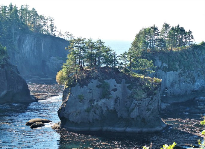
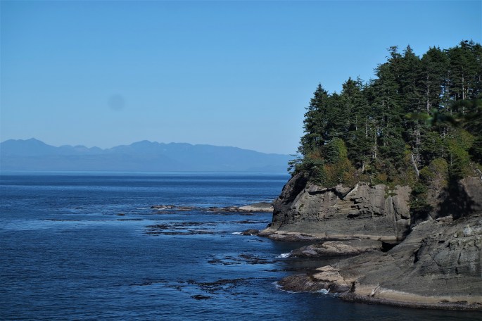
It was another Elks Lodge campground for the next four days. While based in Sequim (pronounced like squid, but with an m), I visited Dungeness Recreation Area and Spit, Neah Bay, Makah Museum and Cape Flattery, Hurricane Ridge, Crescent Lake and several waterfalls. The Olympic Peninsula is awesome and I only had a little rain while in the area.
Dungeness Recreation Area is a national wildlife refuge and one of the world’s longest natural sand spits that softens the rough waves to form a shallow bay and harbor rich with marine life. The spit is five miles long with a lighthouse at the end. The spit sticks out into the Strait of Juan de Fuca. I did not take the hike to the end…10 miles is too long for me, especially on sand! I did see the lighthouse when I took the whale-watching cruise from Port Townsend.
The next day I drove into Olympic National Park for the first time. Sequim and Port Angeles provide easy access to the famous Hurricane Ridge in the park. It’s 17 miles up to the 5,242 foot mountain top where you can view glacier–clad mountains that crown miles of wilderness rich with wildlife. As the name suggests, it is very windy!
Hurricane RidgeThe view from the top of Hurricane RidgeThe mountains are above the clouds!Hurricane Ridge
The Olympic Peninsula has many lakes, rivers, creeks and waterfalls. I visited Lake Crescent, a 624-foot deep glacier carved lake. Legend has it that two well-matched dragons fought nearly to the death and whose hot tears of anguish created the hot springs. This lends a magical touch to the Lake Crescent area. There are many waterfalls in the area including Marymere, Madison Falls and Sol Duc Falls and Hot Springs Resort. All lush and beautiful!
I chose a 70-degree day to venture out to the farthest Northwest point of the continental US, Cape Flattery. Access to Cape Flattery is from Neah Bay and the Makah Indian Reservation. Neah Bay is a very small town with the Makah Museum the highlight of the town. If in the area, be sure to tour the museum and buy a pass to get onto the reservation and see Cape Flattery. It’s a short drive from Neah Bay and a 20 minute hike to the Cape Flattery overlook. Neah Bay is a two hour drive from Sequim, and it is definitely worth the effort to see the Cape.
Walking sticks provided by the Makah for use on the trail.The trail out to Cape FlatteryThe trail gets narrowThe trail crosses creeksAnd then you arrive! Bits of Washington State broken off into the oceanThat is British Columbia across the Strait of Juan de Fuca
Forks
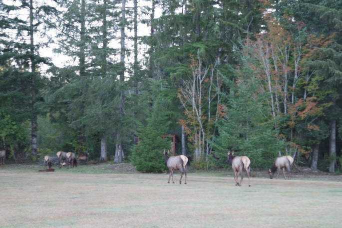
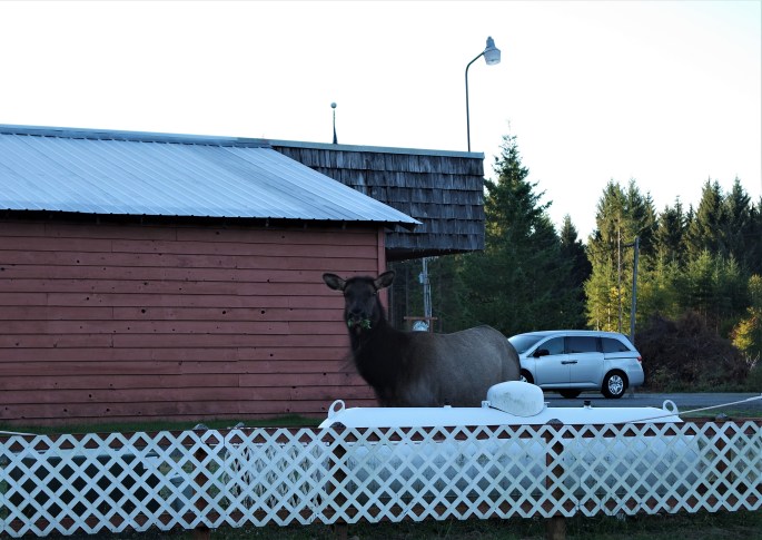
After seeing everything I could from the north area of the park I drove southwest to Forks and stayed at the Fork Elks Lodge, but this time with a twist. There was a resident Elk heard in the immediate area of the lodge! One morning I was awakened by an unusual sound. I looked out the window and I was surrounded by a heard of Elk! Of course, I had to grab my camera and head out the door to take photos. Then I realized how large they are and how close they were to me! So I quickly snapped a few photos and ran back into the rig. It was an awesome way to wake up!
Parked at the Forks Elks Lodge…just the two of us!Elk at the Elks Lodge!Great view of Elk butt as they head into the forest.This sucker is huge!
Forks is a logging town as is the entire Peninsula. Washington is not called the Evergreen State for nothing! However, logging is a dying industry and many small logging towns are in a poor economic condition. Forks was one of those towns until a series of books put Forks on the international map. If you don’t have teenagers, you may not be familiar with the Twilight books. The plot revolves around a group of young vampires living in the Olympic National Park and feeds on animals, not humans. The main female character lives in Forks. The Twilight Series by Stephanie Meyer, has been a big economic boom for Forks. I learned a lot from the visitor center. Before the books, Forks had around 6,500 visitors a year. After the books, 69,000 visitors a year!
The Twilight crew and me!People from all over the US and the world!
While at the Lodge I met some nice people from Wrangle, Alaska. We attended a fund raiser spaghetti dinner for Oscar, a local child with cancer. The money was for his treatments in Seattle. Before my new Alaska friends left they gave me a couple jars of smoked salmon they caught and canned. That was the best smoked salmon I’ve ever tasted. It was bagels and lox for breakfast until I ran out of that yummy salmon.
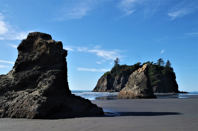
There are many beaches along the coast and I visited several of them; La Push, Rialto, First Beach, and Ruby Beach. I also had lunch at the popular Kalaloch (pronounced clay-loc) Lodge. Such beauty along this rugged coastline!
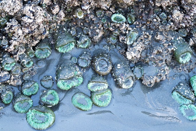
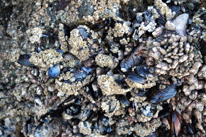
The beachSuch beauty!Tide pool – Sea AnemoneTide pool-Blue Mussels
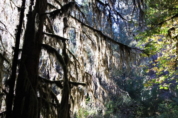
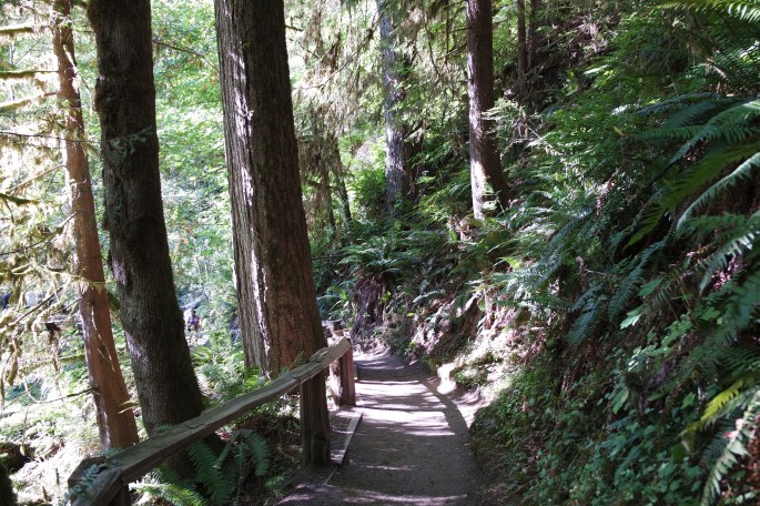
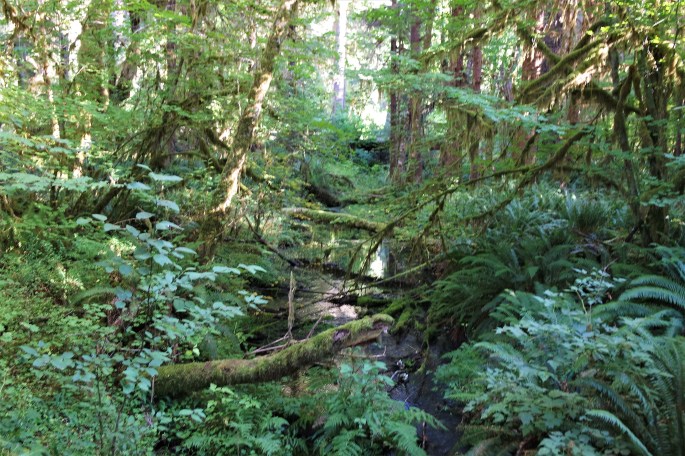
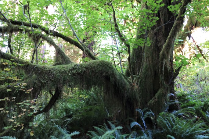
Then it was time for the Hoh Rain Forest. It is among the only protected temperate rain forests in the Northern Hemisphere. The rain forest receives 140 inches of annual rain, and condensed mist brings another 30 inches. The record rainfall is 190 inches! Three loop trails from the visitor center provide a great sampling of the rain forest. My favorite was the Hall of Mosses Trail. Luckily, I didn’t have to visit the rain forest in the rain! It was a beautiful, sunny day.
Dripping with Spanish mossHoh Rain ForestThe trail through the rain forestAll the green!Hoh Rain Forest
As the weather started turning for the worse, it was time for me to start heading south towards Oregon. Honestly, I could spend the entire summer in the Puget Sound area and the Olympic Peninsula. I loved it!
Next stop Portland area and a visit with a dear friend.
The Olympic Peninsula was my next destination. I have friends in Seattle and Tacoma so I chose the Elks Lodge in Shelton, Washington as my home for a week. Shelton is a small town northwest of Olympia and driving distance to Tacoma. In addition, with an hour drive to Bremerton, I could take the ferry to Seattle.
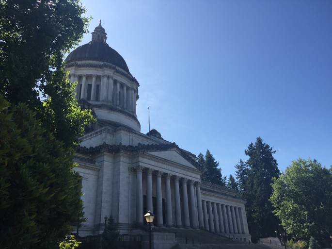
My first outing was to Olympia, the capital of Washington. Olympia is located in the South Puget Sound area. It was Friday and I was a little surprised the capital building area was deserted. In hindsight, I guess I should not have been surprised. Have you ever visited the Sacramento capital building on a Friday? Yes…deserted too!
I arrived just in time to take the last tour of the building. The exquisite neoclassical building opened in 1928. The marble, woodcarvings, light fixtues and old hardware are a remarkable sight. I also learned a little about Washington State government and how the legislators balance the needs of rural Washington (which is most of the state) and the urban areas on the west coast. The tour is definitely worth your time if you are visiting the area.
Washington State Capital Building
I used Yelp to find a delicious Turkish restaurant and had dinner before returning to Shelton. On a trip to Turkey several years ago I was exposed to Turkish cooking and I’ve loved it every since. And let’s not forget the Ephes beer!
Next, I was off to visit Jay and Anne Jackson who recently moved to Tacoma. I met them at a waterfront restaurant for dinner and then went to their house to drink some wine and catch up. I worked with Jay at Public Sector Consultants over many years. We laughed until I had a bellyache! They really like living in the Puget Sound area and I can see why! So much fun visiting with Jay and Anne.
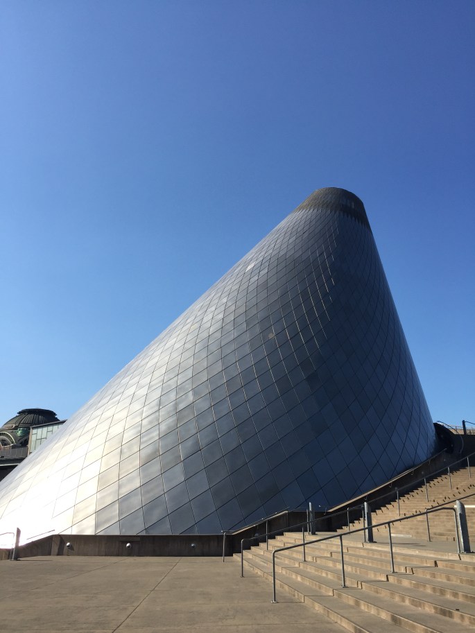
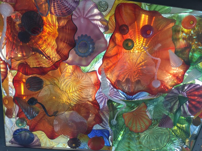
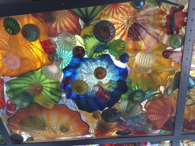
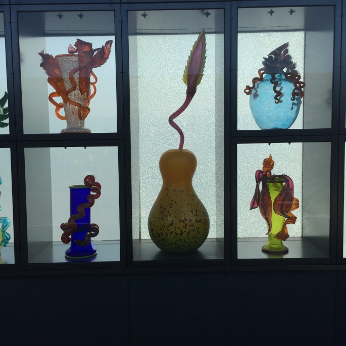
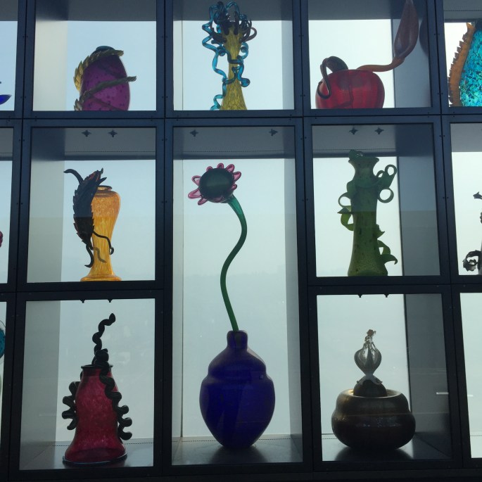
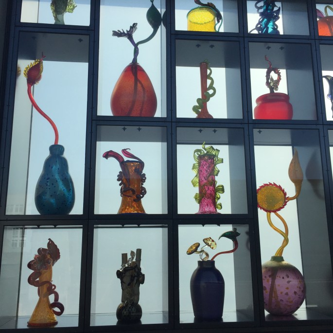
Tacoma is home to the Museum of Glass and the Chihuly Bridge of Glass. The museum highlights extraordinary glass art and has a large Hot Shop where you can sit and watch artists create glass objects. Tacoma is the birthplace of Dale Chihuly, a renowned glass artist and you can learn more about Dale here. Dale’s glasswork is a step beyond. The Bridge of Glass is a walking bridge over the freeway and has numerous pieces of glass art back lit by natural lighting. Stunning! Here is a few photos that of course, don’t do it justice.
Museum of Glass Hot Shop
Glass Ceiling on Bridge of GlassCeiling on Bridge of GlassBridge of GlassBridge of GlassBridge of Glass
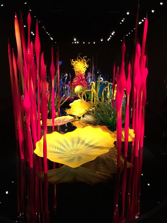
I made the one hour drive to Bremerton to catch the ferry to Seattle to meet my friend Susan Kelly. We visited the Chihuly Garden and Glass. Even though the garden was closed, we toured the glass exhibit and again, a spectacular place!
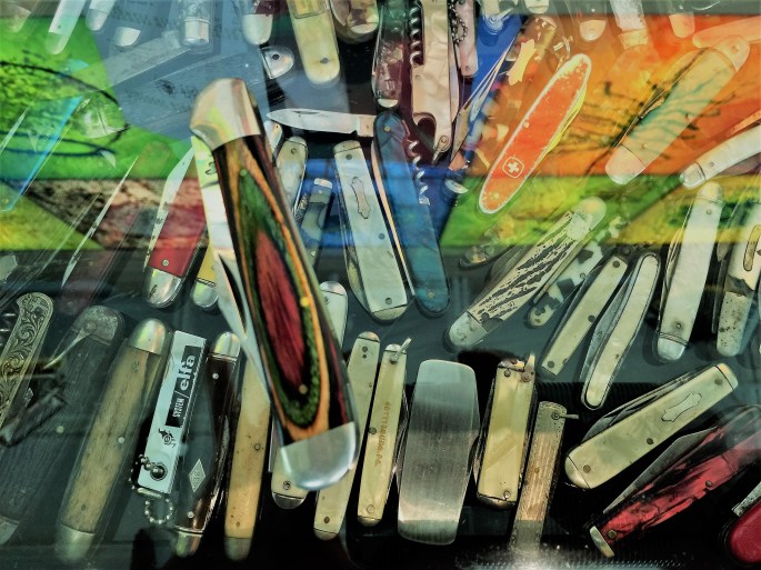
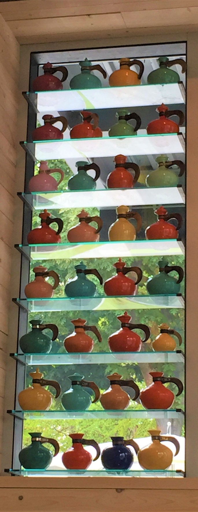
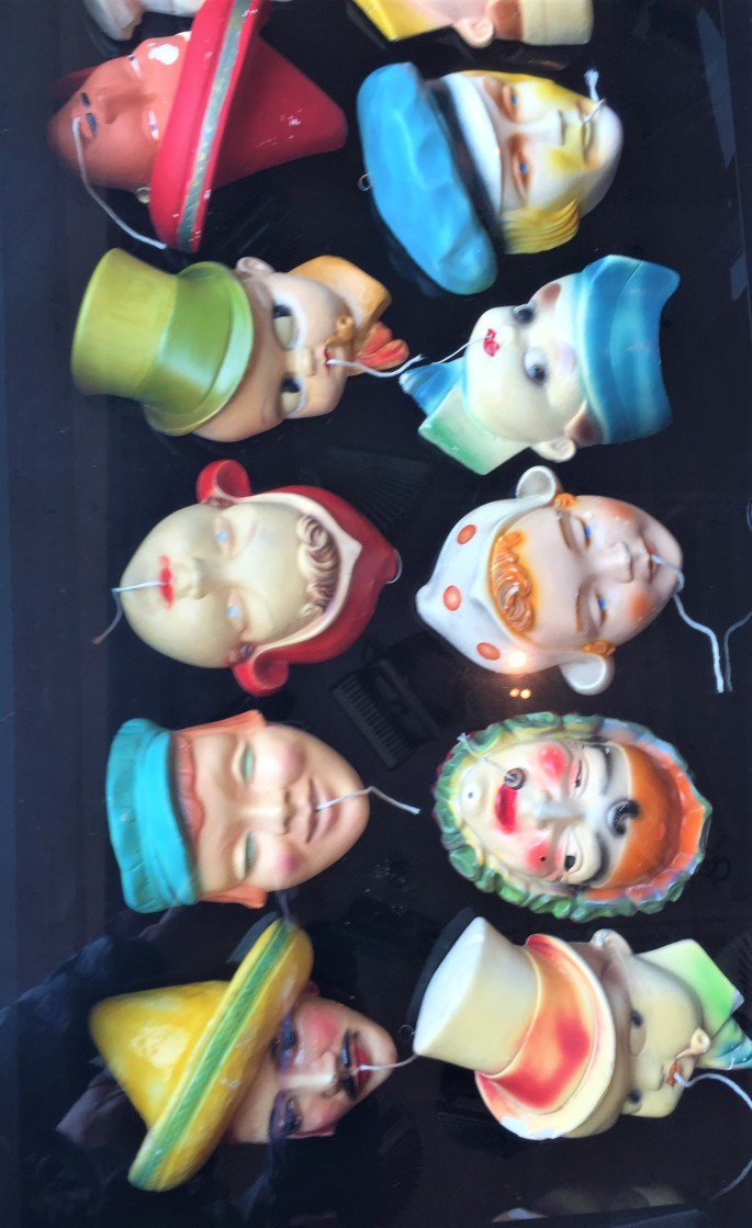
We ate lunch at the Collections Café located at the Chihuly Garden and Glass. The café has delicious food, but that was not the best part. The café is decorated with Chihuly’s personal collection of everyday items. They were everywhere! On the walls, hanging from the ceiling, in the bathrooms, and in the center of the tables (under glass). There are shaving brushes, ceramic dogs, bottle openers, Mexican silver ashtrays, pocketknives (our table), inkwells, alarm clocks, plastic radios, string holders, fish decoys, toy house trailers, accordions, and 1950s cameras. Talk about eye candy! The collections brought back so many memories of childhood.
I searched the plastic radios looking for the one I received from my Great Aunt Lill and Uncle Marv for Christmas when I was around 10 years old. They bought one for me in beige and one for my brother in turquoise. I would listen to that radio with CKLW tuned in, day and night. I think that is where my obsession with music began. Here is a few photos of the collections.
Plastic RadiosOur table had pocket knives. The colorful knife on top is mine. Old Tea PotsCeramic Heads for String
After that, we walked along the waterfront and dropped into the famous Iver’s for a few cocktails before I had to catch the ferry back to Bremerton. It was a fantastic day with a wonderful woman!
Giant head sculptureSeattle from the ferry
I fell in love with the Puget Sound area. So much water everywhere! Many islands to explore (next time) and good friends. If it was not for the weather, I could easily live in this area. But, alas…too much grey and rain for this sun-loving girl. One thing is for sure, this will not be my last visit to the area.
Next stop Port Townsend, Sequim and Olympic National Park.
Everyone left for home and I drove 190 miles to Randle, Washington. Randle served as my base for exploring Mount St. Helens National Volcanic Monument and Mt. Rainier National Park. I stayed at a small park, Shady Firs, recommended by Deb and Mick. There was no AT&T cell signal at the park so I was forced to disconnect from my phone. Due to hurricane Irma bearing down on most of my family, this was a bad time to lose communication. I drove 40 miles (round trip) each day to check on the weather and my family. Everyone was fine and they didn’t even loose power. That’s the worst thing…losing power in hot, humid Florida. Honestly, I’m beginning to wonder why anyone chooses to live in that state.
Summer is over and the campgrounds are returning to “normal”. There are only a few campers at Shady Firs this week. It’s quiet and I love it! And, I was finally out of the smoke zone and the weather was good.
Mount St Helens National Volcanic Monument
This year is the 35th anniversary of the establishment of Mount St. Helens National Volcanic Monument, 110,000 acres in the Gifford Pinchot National Forest. The monument has become a world-renowned laboratory for the study of volcanic processes and ecosystem development following large-scale disturbance.
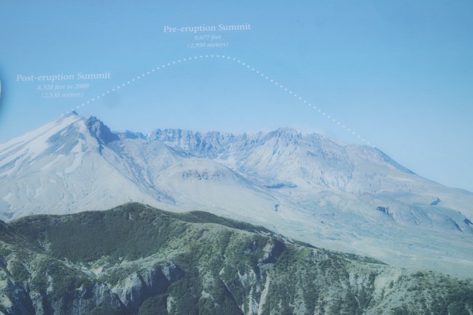
Mount St. Helens is most notorious for its major 1980 eruption, the deadliest and most economically destructive volcanic event in the history of the United States. Fifty-seven people were killed; 250 homes, 47 bridges, 15 miles of railways, and 185 miles of highway were destroyed. A massive debris avalanche triggered by an earthquake measuring 5.1 on the Richter scale caused an eruption that reduced the elevation of the mountain’s summit from 9,677 feet to 8,363 feet , leaving a total of 3,900,000 cubic yards of material that was transported 17 miles south into the Columbia River by the mudflows.
For more than nine hours, a vigorous plume of ash erupted, eventually reaching 12 to 16 miles above sea level. The plume moved eastward at an average speed of 60 miles per hour with ash reaching Idaho by noon. Ashes from the eruption were found collecting on top of cars and roofs the next morning, as far as the city of Edmonton in Alberta, Canada. Learn more here.
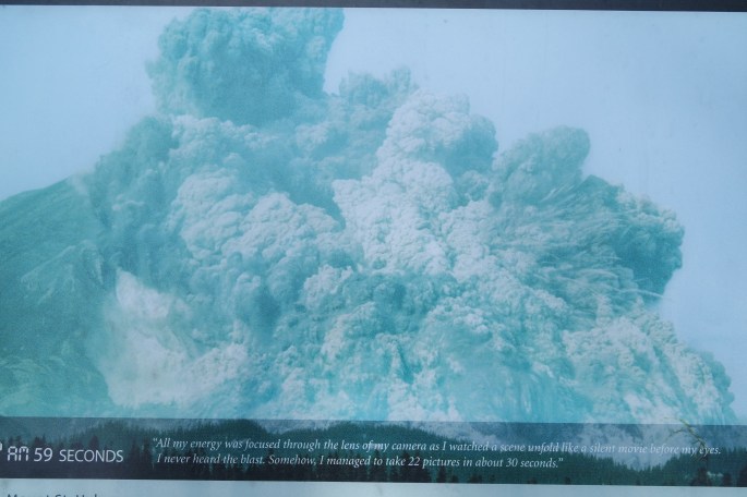
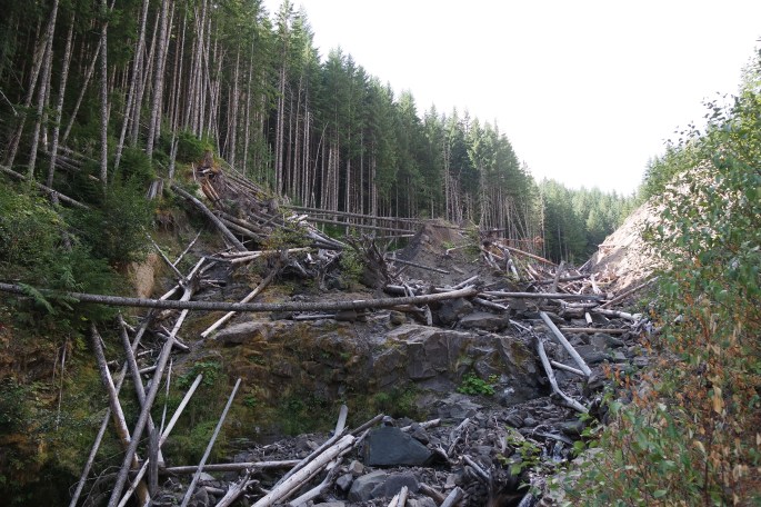
A photographer was lucky enough to not be in the path of the eruption and captured photos as it was happening. The force of the eruption leveled the forest into a river of trees, still present today.
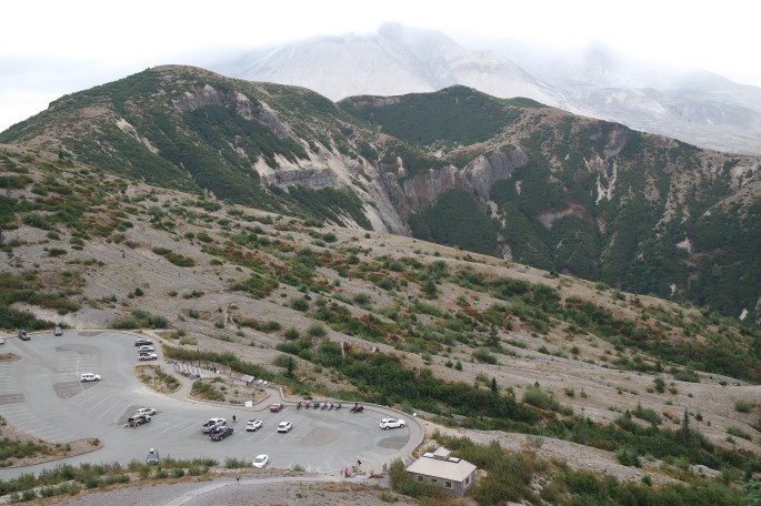
Looking up at the volcano you can see the entire top side missing. It erupted out of the side and top of the mountain. Therefore, part of the forest was untouched. The force of the eruption leveled an entire forest of trees and completely changed the configuration of Spirit Lake. It was hard to image the force of the eruption, even with the evidence right in front of me.
View from the top of a hike. Mount St Helen’s eruption out the top and side of the mountainLook closely and you will see the white dotted line where the mountain was before the eruption
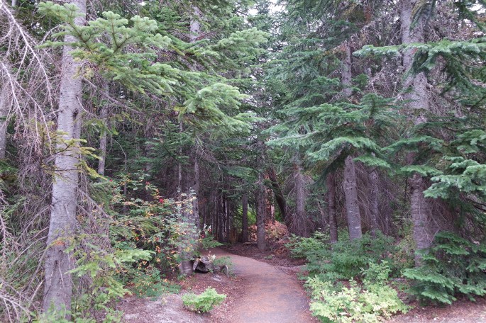
I took a short hike to a small lake and photographed some of the beauty.
Fall is beginningDamage from the beaversDon’t know what this is…it was a beautiful colorDitto on this
I’ve come to realize that many of the places I’m visiting are there because of earthquakes and volcanoes. The reality is that we are living on a humungous ball of magna, ready to explode at any time! Learning about Yellowstone and Mount St Helens drove that point home big time!
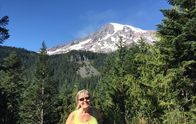
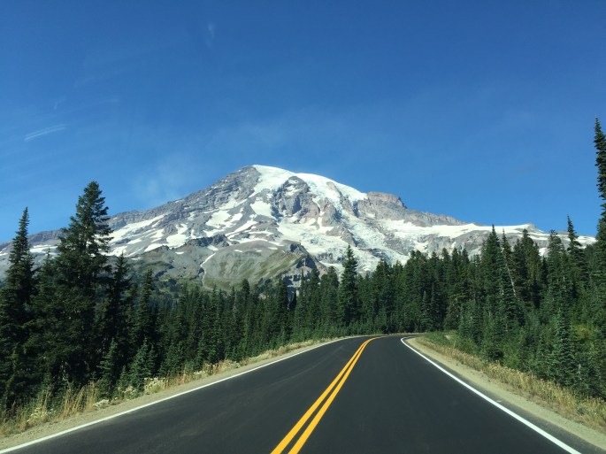
Mount Rainier National Park
“Of all the fire mountains which like beacons, once blazed along the Pacific Coast, Mount Rainier is the noblest.” John Muir
Mount Rainier had not been on my radar screen until Ralph mentioned it to me. I did know it was in Washington but not exactly where. Checking it out on the map, I found it was on my way to the Olympic Peninsula, which was my destination. I’m really happy I visited the park. It was spectacular!
Awesome when you fist spot Mt. Rainier
I waited for a clear, warm day to drive the 40 miles to the park. It turned out to be a perfect clear, 76 degree day and there were very few visitors in the park, which made it even nicer. I was surprised by the beauty of this park.
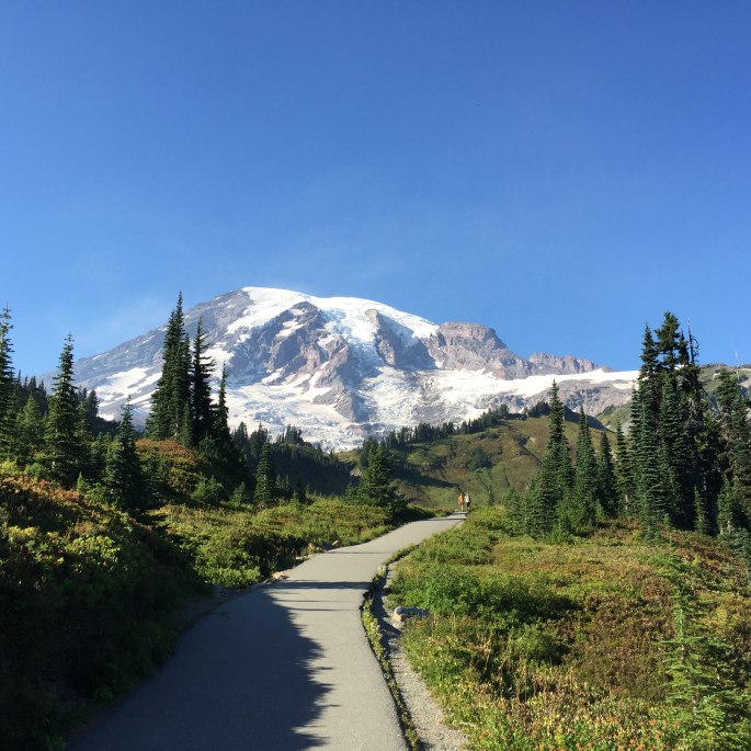
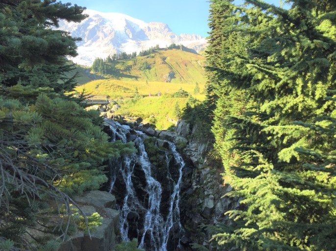
The hike to the fallsMyrtle FallsReflection Lake with a reflection of Mount Rainier
At 14,410 feet, Rainer is the tallest volcano in the Cascade Mountain Range and he most glaciated peak in the continental United States. Glaciers, massive rivers of ice up to 750 feet deep, flow down the rocky slopes. Yet, on the summit, steam escapes from deep within the mountain’s core, reminding you that it is still an active volcano. The park is a step back in time because the roads, buildings, and other structures are nearly one hundred year old. You can hike up the mountain and actually walk on the glacier. I was there too late in the day to take that hike. Maybe next time…
I’m discovering that nature is my religion. When I see the beauty and connectedness of all things in nature I literally become overwhelmed and teary. The more I learn, the more I realize how every thing, from the lichen to the volcano, are interdependent for survival. Often, I cannot believe the beauty I’m seeing with my own eyes. I try to capture it with my camera. The images never are as good as my eyes. I stare for a while, trying to record the site in my brain. I am overcome with gratitude; for being able to travel like I am, for those that came before me and realized they must save these unique areas of our country from the hands of greedy corporations, and for the awesome beauty that unfolds around every curve in the road.
After four days in Randle, it was time to move on to the Puget Sound to visit Olympia, Tacoma and Seattle and my friends Susan Kelly and Anne and Jay Jackson.
Over the five years that I have been researching and reading RV blogs,many say that Glacier National Park is their favorite. Thusly, I made Glacier my goal when I started on this journey. And here I was…in Columbia Falls for two weeks, just outside the park. I couldn’t believe it. I made it all the way from the bottom of Arizona (Bisbee) to the top of Montana! Even I’m impressed! 🙂
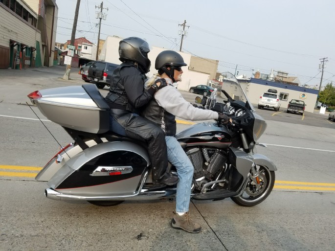
My friends, Mary Ann and Gerard, were still traveling with me. Ralph rode up on his new motorcycle, and our friends, Chris and Bill, along with their dog, Hank, joined us for the second week. We did a little site seeing, played 31 and Mexican Train every night, and had a lot of laughs. Chris and Bill, Ralph and I took a ride around Kootenai Lake before the smoke got so bad that we couldn’t ride.
Ralph, me, Chris and BillHank, the prison dog, is a well-behaved Border Collie trained by prison inmates. We all loved Hank!The new Victory. Very comfortable!
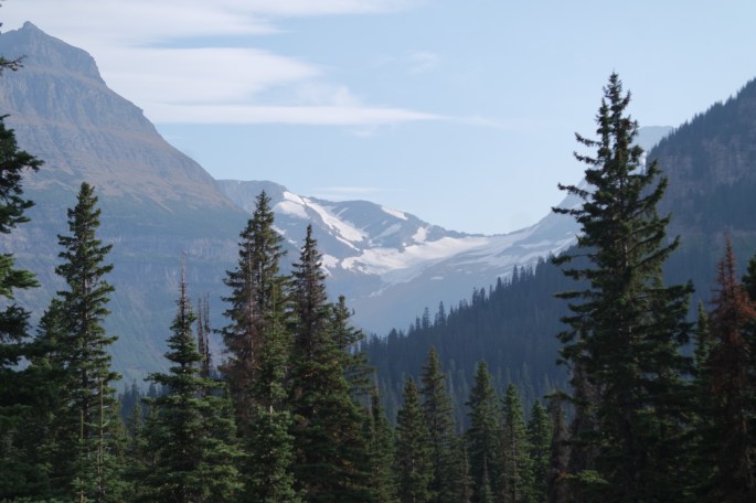
Unbeknownst to us, August in Montana is fire month. This year was particularly bad due to 70+ days of no rain. Fires were burning all around us. When Mary, Gerard and I arrived, the wind was blowing the smoke away from us. We were able to explore the park for three days before the wind changed direction and filled the area with choking smoke. I’ve never experienced this before. By the end of the day, my chest hurt, my eyes burned and I had a sore throat. I was disappointed that I didn’t see the park as it was in photos I’ve seen in the past.
We visited McDonald Lake, St Mary and Many Glacier. We were up and down the Going to the Sun Road many times. The last time was at 10 pm and I’ll tell you that was a little scary. Ralph did a great job driving.
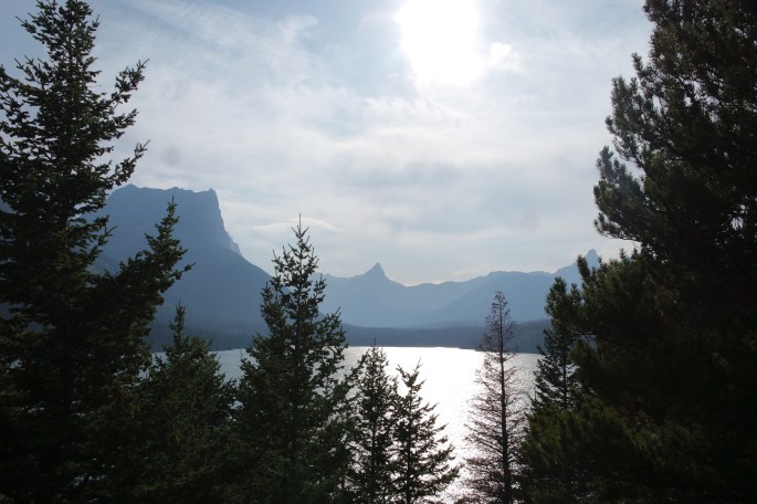
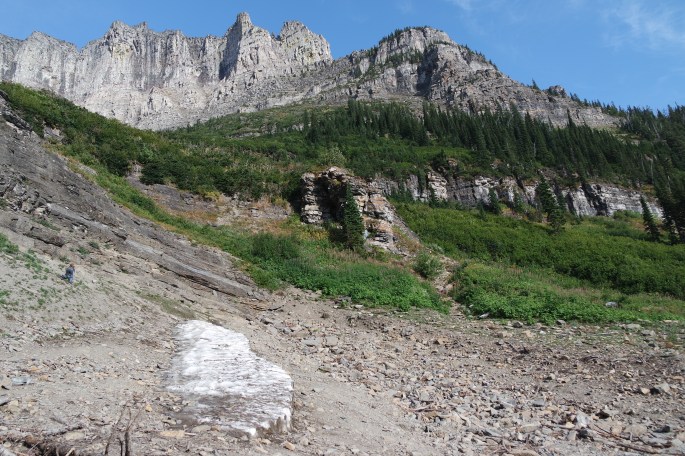
Glacier is a beautiful environment carved out during the last Glacier Age. The name is actually Waterton-Glacier International Peace Park and represents a vision of a world in which peoples set aside their differences to work collectively in the interest of all life, for all time. Waterton is the Canadian part of the park. The park has old-growth forests, wind-swept prairies, ancient glaciers and deep lakes.
My encounter witha stuf bear
Ditto
The Going to the Sun road is 50 miles long and bisects the park east to west. It is a spectacular road that traverses the park’s two largest lakes, hugs the cliffs below the Continental Divide and peaks at Logan Pass.
What is left of a glacierBeautiful lake viewThe turquoise water indicates glacier runoff. Gerard matches! That is an islet in the middle of the lakeOne of the many fallsAll the rocks are so colorful!
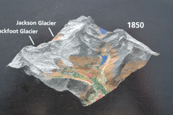
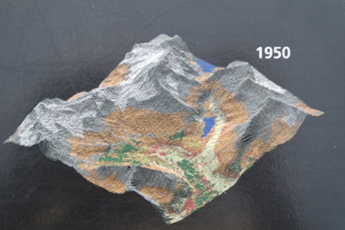
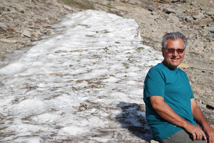
The glaciers are quickly disappearing, so if you want to see them, don’t wait too long to go to the park.
Going, going, gone!
I was disappointed by the smoke and even though Glacier NP is beautiful, my favorite is still Yellowstone.
Another bucket list item checked off!
Gerard sitting an a glacierHere’s the same glacier, ha!
Where to from here? Somewhere where there is clear air!
Our first stop on the way to the Grand Tetons and Yellowstone, was in Evanston, Wyoming. Evanston is just off Interstate 80, and was about half way to Alpine, Wyoming. Alpine would be our home for the time we explored Jackson and the Tetons. It was a beautiful drive from Provo and we arrived early in the afternoon so we had time to check out the Evanston historic district and river walk. We were pleasantly surprised by the great work the small town had done to preserve their old buildings and provide a recreation area (the river walk) for its citizens.
Evanston War Memorial
Natural Recreation Area
Natural Recreation Area
We had a conversation with a couple in their early 90s we met on the street, and learned even more about the town. We stopped at a local brewery, the Suds Brothers and sampled their Bizzy Bee beer and the Red Monkey Butt Amber. I love how creative the local breweries are with the beer names.
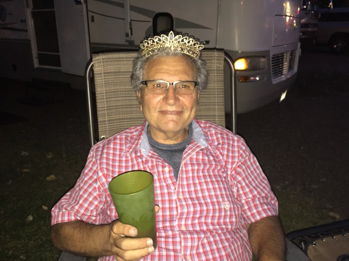
While in Evanston, I also crowned the first Road King! I must admit, there was alcohol involved. Gerard was a good sport. He sort of looks like an old Italian lady, don’t you think? 🙂
Road King Gerard CapraThe Road Queens in a really good mood!
The next morning we were on the road to Alpine, Wyoming which is about 40 miles south of Jackson and the Grand Tetons. It was a steep climb over the mountains and it really pushed that Ford V-10 engine of mine. We slowed to a crawl at 20 mph and I wondered if it would make it to the top. We did. In hindsight, Reine should have driven the car instead of towing it behind the RV. My bad; I hadn’t checked the elevation on the drive. Oh well…another lesson learned! The route took us from Wyoming back through Utah, back into Wyoming, then into Idaho and finally back to Wyoming! It was hysterical watching Reine try to get photos of the welcome signs as we went flying down the road. When we saw the Welcome of Idaho sign, we both exclaimed, “Welcome to Idaho? WTF?” I was wondering if I had taken a wrong turn somewhere. We had not.
Alpine, Wyoming
We used Alpine as our home base for visiting the Tetons. We stayed at Grey’s River Cove campground near the confluence of the Snake and Grey’s River. It was a 45 minute drive to Jackson and just a bit longer to the Teton’s. Reine had to return home part way through our stay and then there were three!
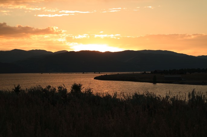
Sunset at our campground
There is a lot to see and do in Jackson and we squeezed in as much as we could. We visited the National Elk Refuge, created in 1912 to protect habitat and provide sanctuary for one of the largest elk herds on earth. It is home to 7,500 elk each winter. The elk herd survives the hard winters of Jackson through a supplementary feeding program. The elk shed their antlers and the Boy Scouts collect the antlers to sell with 75% of the proceeds returned to the refuge to help feed the elk. The largest single herd of bison, (1000+) under federal management, also winter in the refuge.
National Elk Refuge- No elk in the summer. This is their winter home.
Elk Antlers
Moose Antlers
The next day we went rafting on the Snake river one. The scenery was absolutely beautiful!
Rafting on the Snake River
Heading north from Jackson, it’s only a few miles to the Grand Tetons. We took the Jenny Lake ferry and then hiked to Inspiration Point. It was uphill for a mile and just about kicked our collective asses! The view was worth it and the weather was the perfect. Hiking down we broke out into song; “The hills are alive…with the sound of music.” It looked just like the Swiss/Italian Alps! Such beauty! At times, I could not believe my own eyes!
Reine at Inspiration PointHiking above Jenny LakeMary and Gerard on the hikeThe Grand Tetons
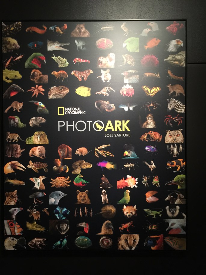
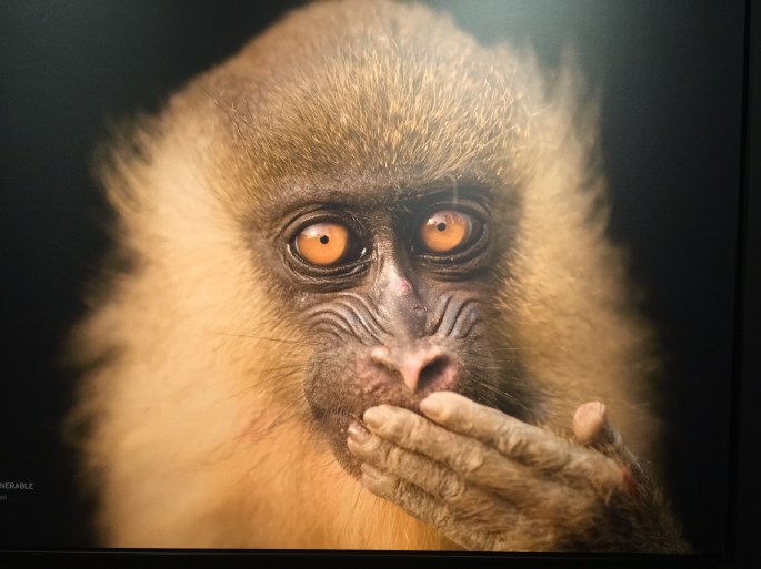
After dropping Reine at the Jackson airport, Mary and I visited the National Museum of Wildlife Art. The museum preserves and exhibits wildlife art. The 51,000 square foot building was inspired by the ruins of Slains Castle in Aberdeenshire, Scotland. The building overlooks the National Elk Refuge and contains truly stunning art of the Jackson and Yellowstone area. Our favorite exhibit was the photographs of endangered species by National Geographic photographer, Joel Satore. Joel is on a 25-year endeavor to document every captive animal species in the world using studio lighting and black and white backgrounds. Thus far, he has photographed 6,500 different species, which leaves approximately 6,000 to go. Joel chronicles his project in his book, The Photo Ark. Here are a few of his photos. Learn more here.
I didn’t realize that it was only going to get more amazing in Yellowstone.
West Yellowstone, Montana
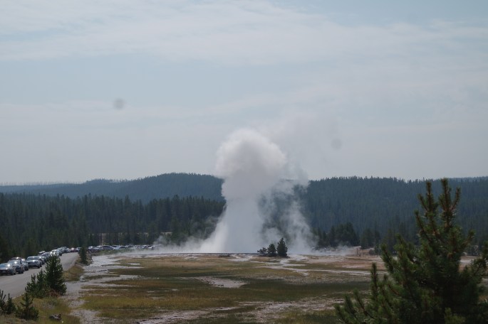
We drove through Grand Teton NP and Yellowstone NP on Hwy 191 to arrive at West Yellowstone and our base camp for visiting Yellowstone National Park. What a beautiful drive! We camped at Yellowstone Holiday RV park on Hebgen Lake. It was a very nice campground with views of the lake. Unfortunately, the smoke in the air got progressively worse during our stay. The last time I visited Yellowstone I was 19 years old and the only thing I remembered was Old Faithful. Was I in for a surprise!
Ever heard of Earthquake Lake? Yeah…me either. On the way to our campground we saw signs for Earthquake Lake on Hwy 287. One afternoon we drove the 17 miles to the visitor center and were astounded that we had never heard of Earthquake Lake and the event from which it was formed. The lake was created after a 7.5 earthquake struck on August 17, 1959, causing an 80-milliom ton landslide, which dammed up the Madison River. The landslide traveled down the south flank of Sheep Mountain, at 100 miles per hour and killed 28 people who were camping along the shores of Hebgen Lake and downstream along the Madison River. The visitor center is built on the top of part of the landslide. There are first hand accounts displayed in the visitor center. Downright chilling as we were camped on the edge of Hebgen Lake. Learn more about this event and its aftermath here.
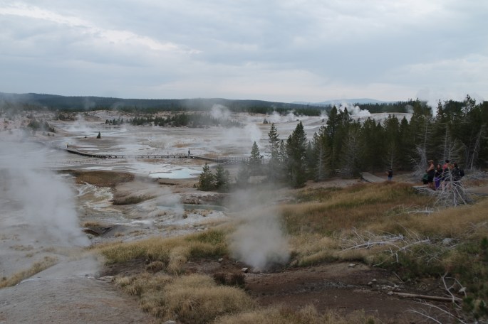
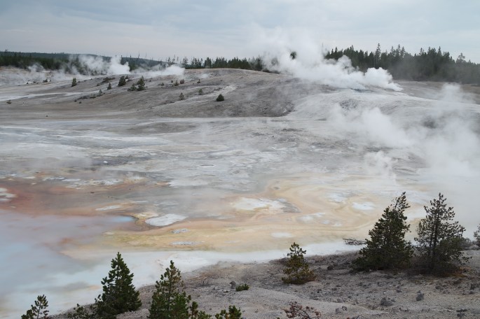
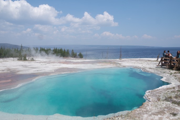
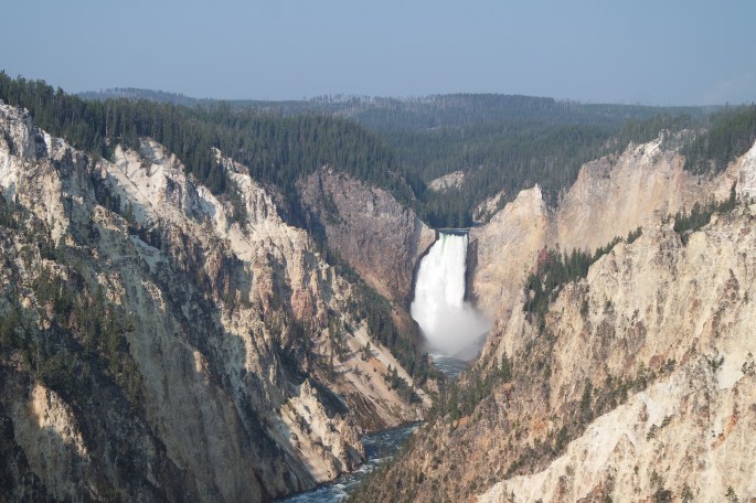
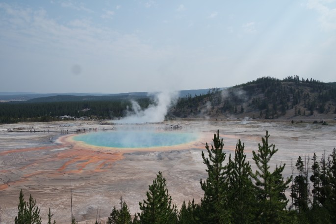
The rest of our time was spent exploring Yellowstone National Park. Gerard did the research and we were able to cover three of the four sections of the park. We missed the northeast section of the park including the Lamar Valley. We did visit Madison Junction to Old Faithful including the Midway Geyser Basin, the Mammoth Hot Springs, Norris Geyser Basic, the Canyon Area (Grand Canyon of Yellowstone), Firehole Lake Drive and Haden Valley, Fishing Bridge Lake Village on Yellowstone Lake, the West Thumb Geyser Basic and, of course, Old Faithful.
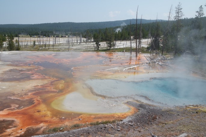
Yellowstone NP is the most unique park I’ve visited. Yellowstone is a giant volcano caldera with hot springs, mudpots, fumaroles (steam vents) and travertine terraces. It’s crazy to realize that we were standing 3 to 5 miles above the hot magna that is our earth and could erupt at any minute! Yellowstone is part of the Pacific Ring of Fire, which is a major area in the basic in of the Pacific Ocean where a large number of earthquakes and volcanos eruptions occur. Learn more here.
Another lesson learned…don’t visit Yellowstone in the summer. It was very crowded which made it difficult to relax and really soak in the natural marvels. We tried going to the park early, late and in between. Between the traffic accidents and the animals in the road, there were many delays. We didn’t let this spoil our visit, but I learned my lesson. I definitely will return to Yellowstone, probably in the spring. Here are just a few of the photos I took at Yellowstone.
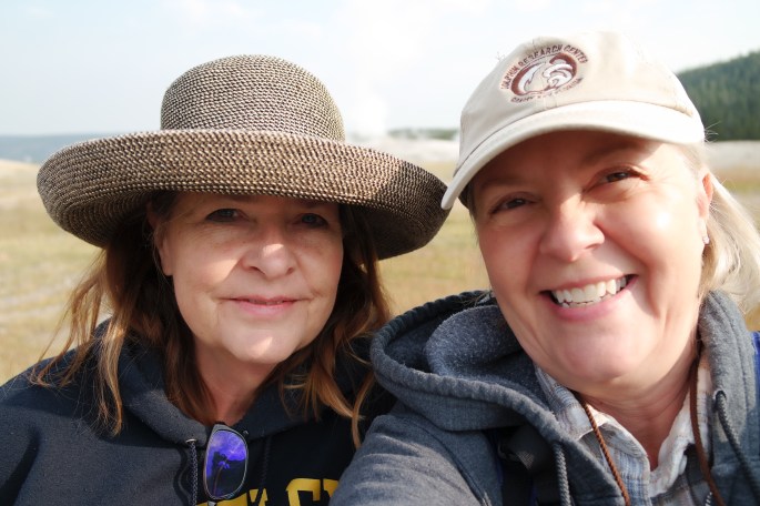
At this point I had no idea what wonders awaited me!Steam spoutsMicroorganisms determine the color of the waterWhite DomeSteam spouts everywhere!Bison on side of roadBison watching me, watching them.One very cold morning in order to get the proper lighting for photos: Gerard and Mary Ann Capra, Lynn Simpkin and yours trulyYellowstone Grand CanyonGrand PrismaticYellowstone wondersA geyser, not Old Faithful
Mary Ann and the Road Queen…I love traveling with friends.
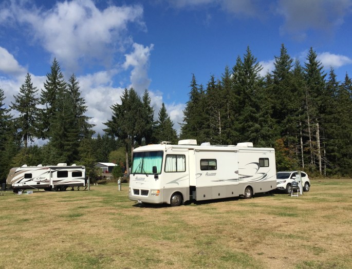
I had a month between visitors and needed to be close the Salt Lake City airport so I picked Richfield to stay for a couple of weeks before heading up to Provo and flying back to Sacramento for 10 days.
Looking for campsites in the summer is a real pain! I’ve read how full-time RVers hate the weekends and summer because it is difficult to find open campsites and indeed this was the case in Utah. The only place I could find was the KOA in Richfield. It was much more expensive, (as KOAs always are), than I usually pay, ($47/night at the weekly rate), but I didn’t have much choice. It turned out to be a nice campsite, large level site, big concreate patio with log fencing, and a pool. Richfield isn’t much of a town, but it did have a Walmart. Yes I get excited when these small towns have a Walmart! From Richfield I was able to visit Capital Reef National Park and Fremont Indian State Park. I also had time to check some things off my “To Do” list. It was bloody hot; hovering near 100 the entire time, so the pool came in very handy.
I met several of the workcampers working at the campground through RVillage, a social networking site for RVers. It was nice to have friends, however temporary, to hang out with by the pool and talk to when I felt the need for socializing. We all saw the Richfield fireworks on July 4th. All we have to do was take a chair and walk outside the side gate of the campground to watch the fireworks. They were quite good for such a small town.
Capital Reef National Park is in Utah’s south-central desert. It surrounds a long wrinkle in the earth known as the Waterpocket Fold, with layers of golden sandstone, canyons and striking rock formations. Among the park’s sights are the Chimney Rock pillar, the Hickman Bridge arch, and Capitol Reef, known for its white sandstone domes. In the north are the towering monoliths of Cathedral Valley.
SAMSUNG CAMERA PICTURES
SAMSUNG CAMERA PICTURES
SAMSUNG CAMERA PICTURES
SAMSUNG CAMERA PICTURES
SAMSUNG CAMERA PICTURES
SAMSUNG CAMERA PICTURES
SAMSUNG CAMERA PICTURES
SAMSUNG CAMERA PICTURES
SAMSUNG CAMERA PICTURES
SAMSUNG CAMERA PICTURES
The Fremont Indians inhabited the area around 1,000 AD. In the 1880’s Mormons settled the area now called Fruita. They planted orchards that are still producing today. I’m still eating the peach jam I bought in Fruita from the trees planted by the Mormons. They also sell delicious pies made from the fruit of those trees.
I took the scenic drive through the Capital Gorge canyon. I used my Go-Pro wannabe, SJ4000 action cam for the first time. I’m learning to shoot video to add to my blog. Here’s my first try.
Capital Reef does not have the crowds that other national parks do in the summer. It was about an hour and a half drive from Richfield through scenic mountains. It is well worth a visit.
Fremont Indian State Park is right outside Richfield and is definitely worth a visit. It has the archaeological remains of the Fremont culture. The site was discovered during construction of Interstate 70, and thousands of artifacts have been excavated from the ancient village and put on permanent display at the museum. The Fremont Indians were agriculturalists who lived from about 400 to 1300 in north and central Utah and adjacent parts of Colorado, Idaho and Nevada. The Fremont are thought to have come from hunter-gatherers who previously lived in this location and were influenced by the Ancient Pueblo Peoples who introduced corn and pottery, making year-round settlements possible.
Ancient Petroglyphs
Ancient Petroglyphs
Provo, Uath
I chose Provo because I needed to be close to an airport to fly to Sacramento for 10 days to attend Jane’s Lobster Feed and take care of a couple health appointments. Provo is 40 miles from the Salt Lake City airport and home to Brigham Young University. It also had an Elks Lodge where I could stay and store my RV while in Sacramento.
The Provo Elk’s Lodge is a fairly new (five years) lodge with a large parking area. It has room for five electric/water sites and three dry camping sites. There was only a couple RVs parked at any one time. When in Provo, I’d certainly stay there again.
Doesn’t look like a happy elk to me!
Provo Elk’s Lodge “camping”
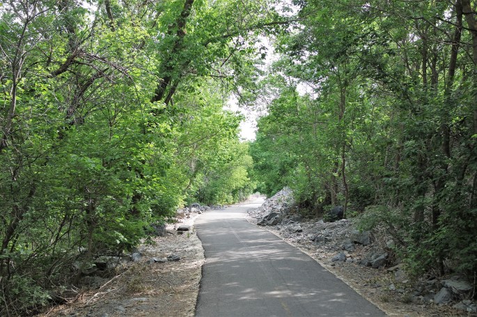
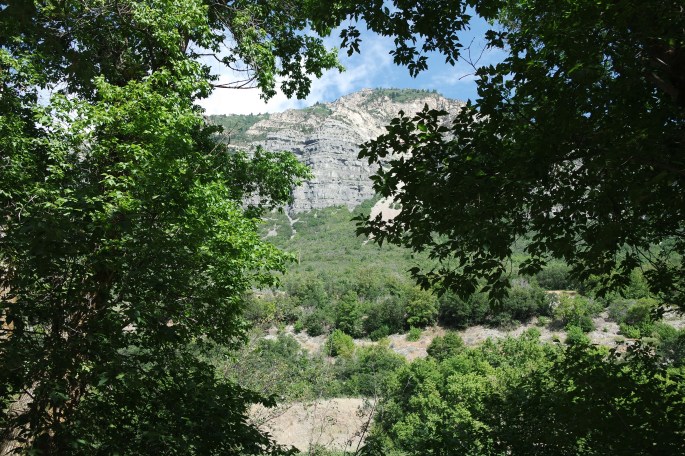
Before leaving for Sacramento, I took the short trip (8 miles) to Provo Canyon for a hike to Bridal Veil Falls and then continued to the Sundance Resort.
Provo Canyon TrailBridal Veil Falls with some crazy people!
The Sundance Resort is nothing like I imagined. It is very rustic and low key. According to Wiki, “Sundance Mountain Resort is a ski resort located 13 miles northeast of Provo, Utah. It spans over 5,000 acres on the slopes of Mount Timpanogos in Utah’s Wasatch Range. Alpine skiing began on the site in 1944. Actor Robert Redford acquired the area in 1968, and established a year-round resort which would later spawn the independent Sundance Film Festival and the non-profit Sundance Institute. Sundance is committed to the balance of art, nature and community.” I checked into tickets for the film festival. You need to buy your tickets the minute they are released a year in advance in order to get a ticket. Maybe someday… I walked around and had lunch before heading back to the RV.
Sundance Resort Building
Sacramento, CA
The purpose of my trip to Sacramento was to attend Jane’s Bridge School fundraiser lobster feed at her home in St. Helena. This is always a fun event and gave me a chance to see a few people I hadn’t seen in a long time. It was also my birthday. It was unusually hot in St Helena the day of the event and the dinner was outdoors. We did our best to stay cool by drinking a lot of cold beer! Everyone had a wonderful time and the food was fantastic. After a few days at Jane’s house, I went to Sacramento and stayed with Ralph (and of course, Freddy the Freeloader). I do miss my guys! I went to the eye appointment, the dentist and got my hair done. A very productive week indeed!
Note: Click on photo to see caption.
Dinner in the driveway
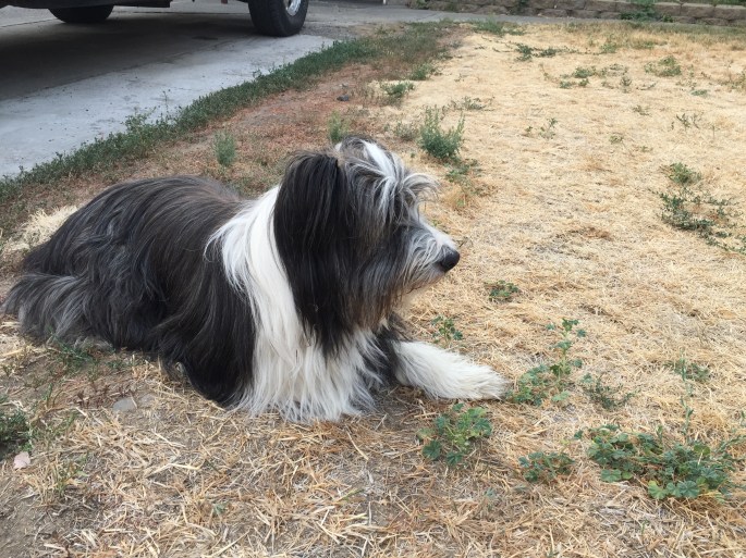
Beau – my favorite dog. He’s Jane’s dog.
Gina and Jane
My kind of dinner party…Throw it on the table and roll up table cloth to clean up!
Something for everyone!
I returned to Provo with a bookie in tow (my book club friend, Reine). Mary Ann and Gerard Capra joined us in their RV and we all headed to the Grand Tetons. Reine traveled with us for 10 days and then flew back to Sacramento from Jackson Hole, Wy. Having girlfriends join me for segments of my travels has been a wonderful time for me. It’s been great to spend extended one-on-one time with these wonderful women. I am blessed in so many ways!
Another road queen Tierra N’ Up The Road!
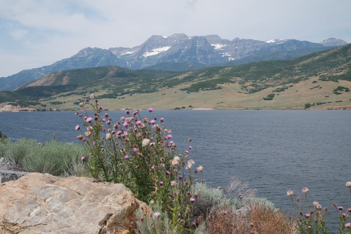
Park City, Utah
We drove up to Park City to check it out and to meet a friend, Sue Robinson. Sue has lived in Park City for 15+ years. Park City is known for it’s wonderful skiing in the winter and recreational activities in the summer. It is an upscale town with restaurants, galleries and small shops. We met Sue for dinner and spent most of the time talking telecom and walking down memory lane. We had a great time and all commented, “We will be back, Park City!”
The drive to Park CityThe drive to Park CityOnce a telecom girl…always a telecom girl! Me, Sue Robinson, Mary Ann Capra, Reine Thibeault